
Soubor:Map of Bielitz 1855 (2).jpg

Původní soubor (1 366 × 768 pixelů, velikost souboru: 641 KB, MIME typ: image/jpeg)
| Tento soubor pochází z Wikimedia Commons. Níže jsou zobrazeny informace, které obsahuje jeho tamější stránka s popisem souboru. |
.jpg)
| Popis |
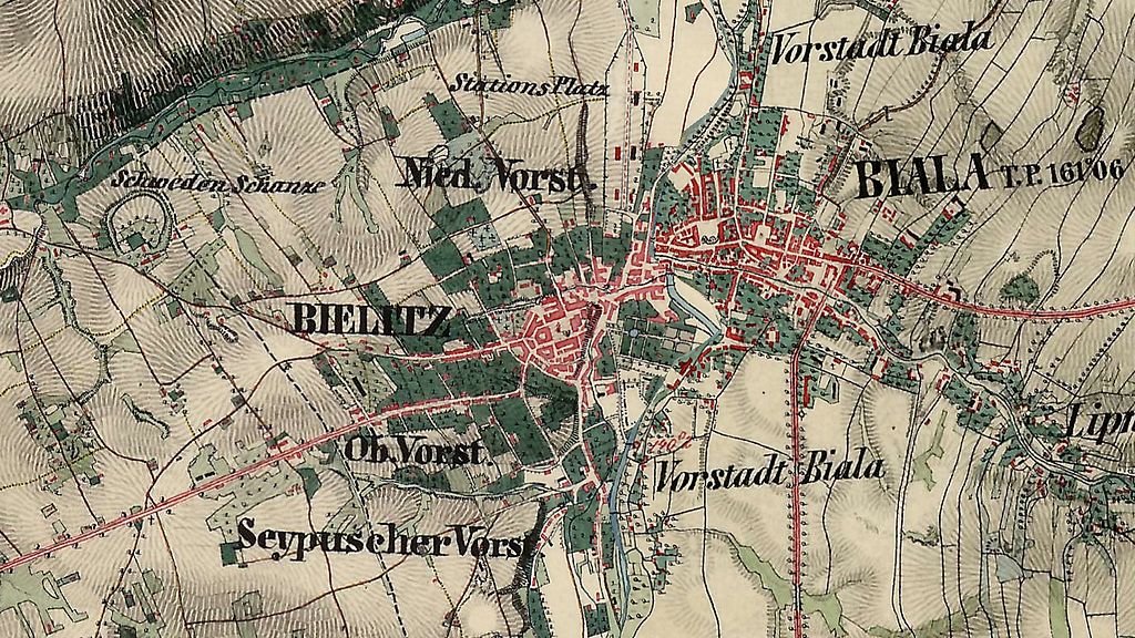
English: Austrian topographic map of Bielsko and Biała (Bielitz and Biala).
Polski: Austriacka mapa topograficzna Bielska i Białej.
Deutsch: Eine österreichische topographische Karte von Bielitz und Biala.
Čeština: Rakouska topografická mapa Bílska a Bělé.
Ślůnski: Austryjackŏ topograficznŏ mapa Biylska a Biŏłyj. |
||||
| Datum | mezi 1855 a 1869 | ||||
| Zdroj | Neznámý | ||||
| Autor | Franziszeische Landesaufnahme (online) | ||||
| Svolení (Užití tohoto souboru) |
|
||||
| Další verze |
 |
||||
Historie souboru
Kliknutím na datum a čas se zobrazí tehdejší verze souboru.
| Datum a čas | Náhled | Rozměry | Uživatel | Komentář | |
|---|---|---|---|---|---|
| současná | 21. 8. 2016, 12:09 | | 1 366 × 768 (641 KB) | Gaj777 | lepsza wersja |
| 26. 8. 2008, 14:44 |  | 808 × 406 (132 KB) | Gaj777 | {{Information |Description={{en|Map of Bielitz (Bielsko) in 1855. </br>}} {{pl|Mapa Bielitz (Bielsko) z 1855 r.}} |Source= |Date=1855-1860 |Author= |Permission={{pd-old}} |other_versions=200px }} Category:Bielsko-Biała |
Využití souboru
Tento soubor používají následující 2 stránky:
Globální využití souboru
Tento soubor využívají následující wiki:
- Využití na de.wikipedia.org
- Využití na en.wikipedia.org
- Využití na pl.wikipedia.org
.jpg)