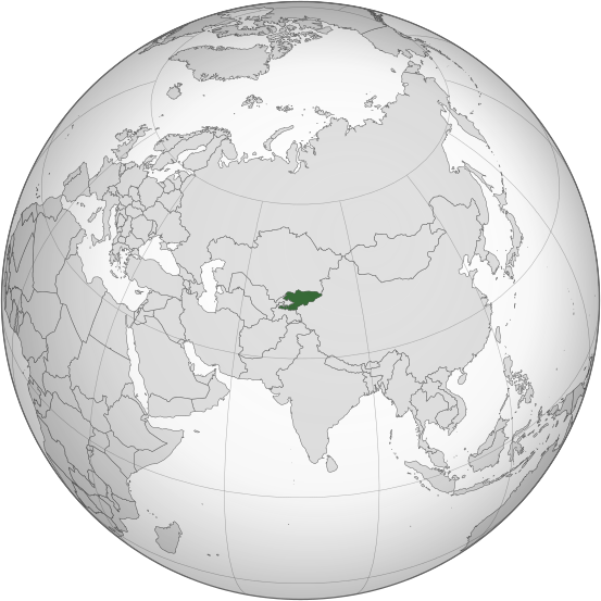
Soubor:Kyrgyzstan (orthographic projection).svg

Velikost tohoto PNG náhledu tohoto SVG souboru: 553 × 553 pixelů. Jiná rozlišení: 240 × 240 pixelů | 480 × 480 pixelů | 768 × 768 pixelů | 1 024 × 1 024 pixelů | 2 048 × 2 048 pixelů.
Původní soubor (soubor SVG, nominální rozměr: 553 × 553 pixelů, velikost souboru: 346 KB)
Historie souboru
Kliknutím na datum a čas se zobrazí tehdejší verze souboru.
| Datum a čas | Náhled | Rozměry | Uživatel | Komentář | |
|---|---|---|---|---|---|
| současná | 31. 7. 2023, 03:08 |  | 553 × 553 (346 KB) | Cutlass | rv sock edits |
| 6. 6. 2023, 18:09 |  | 553 × 553 (310 KB) | Cutlerys | Reverted to version as of 12:34, 4 August 2013 (UTC) | |
| 6. 6. 2023, 18:08 |  | 553 × 553 (306 KB) | Cutlerys | Reverted to version as of 23:39, 16 March 2015 (UTC) | |
| 1. 5. 2016, 20:17 |  | 553 × 553 (346 KB) | Nicolay Sidorov | ... | |
| 17. 3. 2015, 01:39 |  | 553 × 553 (306 KB) | Flappiefh | Removed Somaliland and Kosovo. Separated Western Sahara and Morroco. | |
| 4. 8. 2013, 14:34 |  | 553 × 553 (310 KB) | Flappiefh | Added South Sudan. The map is now centered on Kyrgyzstan. | |
| 9. 7. 2012, 18:02 |  | 550 × 550 (490 KB) | Hariboneagle927 |
Využití souboru
Tento soubor používají následující 2 stránky:
Globální využití souboru
Tento soubor využívají následující wiki:
- Využití na ady.wikipedia.org
- Využití na af.wikipedia.org
- Využití na ami.wikipedia.org
- Využití na ar.wikipedia.org
- Využití na arz.wikipedia.org
- Využití na ast.wikipedia.org
- Využití na as.wikipedia.org
- Využití na av.wikipedia.org
- Využití na azb.wikipedia.org
- Využití na bcl.wikipedia.org
- Využití na bg.wikipedia.org
- Využití na bh.wikipedia.org
- Využití na bi.wikipedia.org
- Využití na blk.wikipedia.org
- Využití na bn.wikipedia.org
- Využití na ca.wikipedia.org
- Využití na cdo.wikipedia.org
- Využití na ceb.wikipedia.org
- Využití na cy.wikipedia.org
- Využití na dag.wikipedia.org
- Využití na da.wikipedia.org
- Využití na de.wikivoyage.org
- Využití na diq.wikipedia.org
- Využití na el.wikipedia.org
- Využití na en.wikipedia.org
- Využití na en.wikinews.org
- Využití na eo.wikipedia.org
- Využití na es.wikipedia.org
- Využití na fa.wikipedia.org
- Využití na fi.wikipedia.org
- Využití na fo.wikipedia.org
- Využití na frr.wikipedia.org
- Využití na fr.wikipedia.org
Zobrazit další globální využití tohoto souboru.

