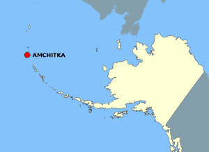
Soubor:AmchitkaAlaskaLoc.png

Obsah stránky není podporován v jiných jazycích.
Z Wikipedie, otevřené encyklopedie

AmchitkaAlaskaLoc.png(300 × 219 pixelů, velikost souboru: 14 KB, MIME typ: image/png)

Popis

Popis

This map is a derivative work of a map layer from nationalatlas.gov, which states: "We have begun by collaboratively building "frameworks," the essential map layers that provide a foundation for all other maps. These basic layers, including small-scale harmonized information on North American roads, water, boundaries and the like, are being offered here for the first time. Like all other raw data and documentation offered here on nationalatlas.gov, these frameworks can be downloaded at no cost and used freely without copyright concerns or license restrictions."[1]

I donate the modifications and the resulting work to the public domain.
Zdroj see above
Autor National Atlas - DW: Jakew

Licence

Public domain
Tato mapa byla získána z vydání Národního atlasu Spojených států. Jako téměř všechna díla federální vlády USA, jsou i díla z Národního atlasu Spojených států volným dílem.
Přístup online: NationalAtlas.gov | tištěné vydání z roku 1970: Knihovna Kongresu, Knihovna Perry-Castañeda

čeština | Deutsch | English | français | Bahasa Indonesia | italiano | македонски | മലയാളം | sicilianu | 中文 | 中文(简体)‎ | 中文(繁體)‎ | +/−

Původní historie souboru

Původní stránka s popisem souboru byla zde. Všechna následující uživatelská jména odkazují na projekt en.wikipedia.
  • 2006-10-08 16:15 Jakew 300×219×8 (14678 bytes) This map is a derivative work of a map layer from nationalatlas.gov, which states: "We have begun by collaboratively building "frameworks," the essential map layers that provide a foundation for all other maps. These basic layers, including small-scale ha

Popisky

Přidejte jednořádkové vysvětlení, co tento soubor představuje

Položky vyobrazené v tomto souboru

zobrazuje

29373e1014db60b020fe042aeb20de37cd506fdd

14 678 bajt

219 pixel

300 pixel

Historie souboru

Kliknutím na datum a čas se zobrazí tehdejší verze souboru.

Datum a časNáhledRozměryUživatelKomentář
současná2. 8. 2007, 23:20Náhled verze z 2. 8. 2007, 23:20300 × 219 (14 KB)Adam~commonswiki{{Information |Description=This map is a derivative work of a map layer from nationalatlas.gov, which states: "We have begun by collaboratively building "frameworks," the essential map layers that provide a foundation for all other maps. These basic layer

Tento soubor používají následující 2 stránky:

Globální využití souboru

Tento soubor využívají následující wiki: