
Soubor:Mapa de Provincias Corea.svg

Velikost tohoto PNG náhledu tohoto SVG souboru: 320 × 599 pixelů. Jiná rozlišení: 256 × 480 pixelů | 410 × 768 pixelů | 547 × 1 024 pixelů | 1 094 × 2 048 pixelů | 716 × 1 340 pixelů.
Původní soubor (soubor SVG, nominální rozměr: 716 × 1 340 pixelů, velikost souboru: 353 KB)
| Tento soubor pochází z Wikimedia Commons. Níže jsou zobrazeny informace, které obsahuje jeho tamější stránka s popisem souboru. |
Popis
| Popis |
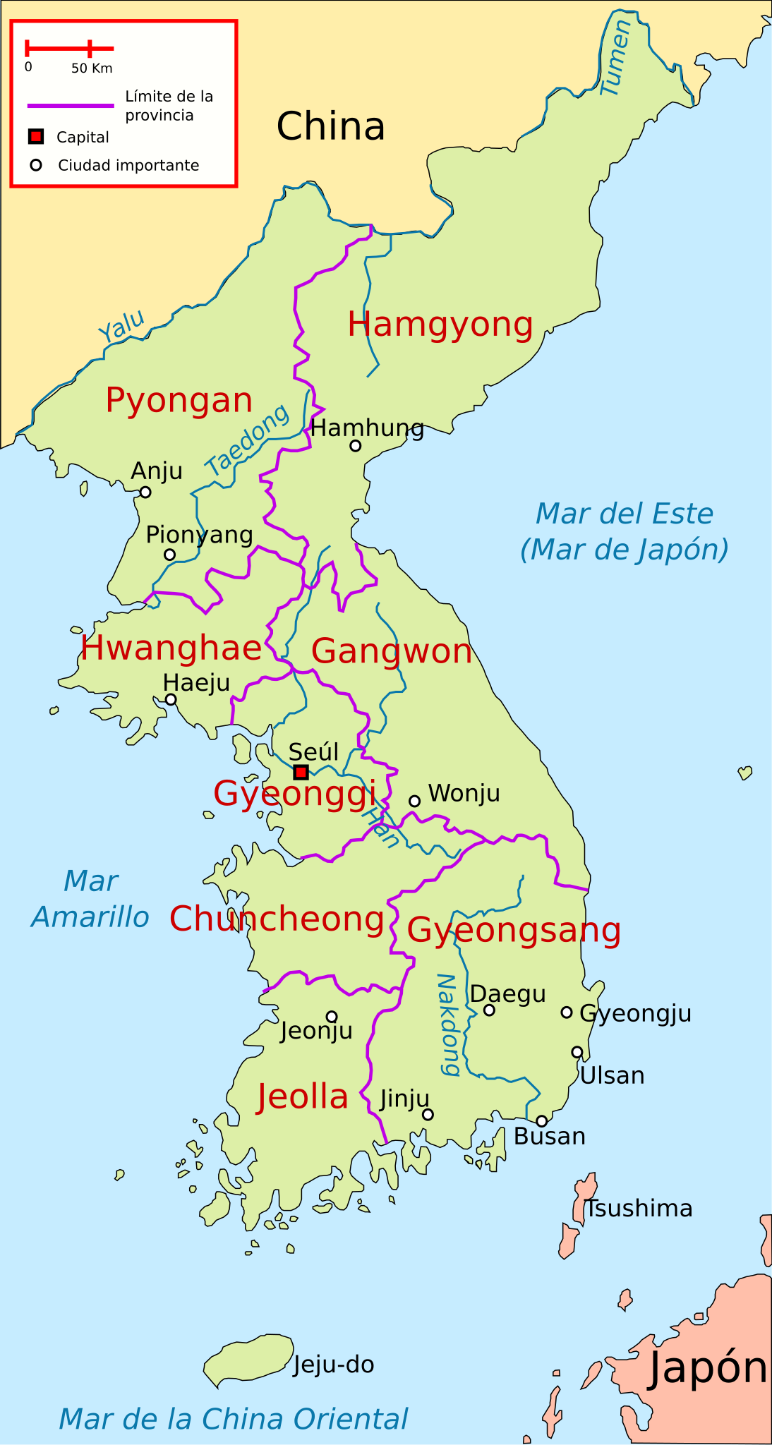
Español: Ubicación de las antiguas 8 provincias de Corea y las principales ciudades |
| Datum | |
| Zdroj | Vlastní dílo, based on Image:Map of korea.png (deleted) and Image:Korea-8provinces.jpg |
| Autor | Rage against |
| SVG vývoj | Tento vektorový obrázek byl vytvořen programem Inkscape, or with something else. |
Licence
Já, držitel autorských práv k tomuto dílu, ho tímto zveřejňuji za podmínek následujících licencí:

|
Tento dokument smí být kopírován, šířen nebo upravován podle podmínek Svobodné licence GNU pro dokumenty verze 1.2 nebo libovolné vyšší verze publikované nadací Free Software Foundation. Dokument nemá neměnné části ani texty na předním či zadním přebalu. Kopie textu licence je k dispozici v oddíle nazvaném GNU Free Documentation License. |
Tento soubor podléhá licenci Creative Commons Uveďte autora 3.0 Unported
- Dílo smíte:
- šířit – kopírovat, distribuovat a sdělovat veřejnosti
- upravovat – pozměňovat, doplňovat, využívat celé nebo částečně v jiných dílech
- Za těchto podmínek:
- uveďte autora – Máte povinnost uvést autorství, poskytnout odkaz na licenci a uvést, pokud jste provedli změny. Toho můžete docílit jakýmkoli rozumným způsobem, avšak ne způsobem naznačujícím, že by poskytovatel licence schvaloval nebo podporoval vás nebo vaše užití díla.
Můžete si zvolit libovolnou z těchto licencí.
Historie souboru
Kliknutím na datum a čas se zobrazí tehdejší verze souboru.
| Datum a čas | Náhled | Rozměry | Uživatel | Komentář | |
|---|---|---|---|---|---|
| současná | 29. 7. 2019, 01:14 | | 716 × 1 340 (353 KB) | Rowanwindwhistler | Minor changes |
| 16. 3. 2010, 07:22 |  | 716 × 1 340 (108 KB) | Rαge | + Mar del Este | |
| 31. 1. 2009, 12:25 |  | 716 × 1 340 (107 KB) | Valentim | Minor corrections | |
| 31. 1. 2009, 12:19 |  | 716 × 1 340 (108 KB) | Valentim | Unnecessary informations deleted (less informations make pictures more transparent) + "Mar de la China Oriental" | |
| 19. 1. 2009, 19:52 |  | 716 × 1 340 (107 KB) | Rαge | {{Information |Description= |Source= |Date= |Author= |Permission= |other_versions= }} | |
| 23. 10. 2008, 02:23 |  | 716 × 1 340 (107 KB) | Rαge | {{Information |Description={{es|1=Ubicación de las antiguas 8 provincias de Corea y las principales ciudades}} |Source=trabajo propio (own work), based on Image:Map_of_korea.png and Image:Korea-8provinces.jpg |Author=[[User:Rage against|Rage ag |
Využití souboru
Tento soubor nepoužívá žádná stránka.
Globální využití souboru
Tento soubor využívají následující wiki:
- Využití na es.wikipedia.org