
Soubor:Yazoo river.gif

Velikost tohoto náhledu: 477 × 599 pixelů. Jiná rozlišení: 191 × 240 pixelů | 382 × 480 pixelů | 776 × 975 pixelů.
Původní soubor (776 × 975 pixelů, velikost souboru: 46 KB, MIME typ: image/gif)
| Tento soubor pochází z Wikimedia Commons. Níže jsou zobrazeny informace, které obsahuje jeho tamější stránka s popisem souboru. |
| Popis |
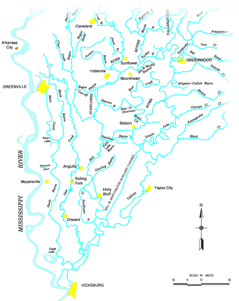
Map of the Yazoo River watershed — located in Mississippi.
|
|||
| Zdroj |
http://www.mvk.usace.army.mil/offices/pp/projects/yazoobackwater/docs/01app4.pdf[dead link] |
|||
| Autor | ||||
| Svolení (Užití tohoto souboru) |
|
Historie souboru
Kliknutím na datum a čas se zobrazí tehdejší verze souboru.
| Datum a čas | Náhled | Rozměry | Uživatel | Komentář | |
|---|---|---|---|---|---|
| současná | 19. 11. 2006, 21:19 | | 776 × 975 (46 KB) | PhilFree | Yazoo River, USA. The image uploaded is modified from the original created by U. S. Army Corps of Engineers' Vicksburg District ([http://www.mvk.usace.army.mil/offices/pp/projects/yazoobackwater/docs/01app4.pdf Yazoo Backwater Reformulation Report (pdf)]) |
Využití souboru
Tento soubor používá následující stránka:
Globální využití souboru
Tento soubor využívají následující wiki:
- Využití na ar.wikipedia.org
- Využití na da.wikipedia.org
- Využití na de.wikipedia.org
- Využití na en.wikipedia.org
- Využití na es.wikipedia.org
- Využití na fr.wikipedia.org
- Využití na fy.wikipedia.org
- Využití na it.wikipedia.org
- Využití na pl.wikipedia.org
- Využití na sv.wikipedia.org
- Využití na www.wikidata.org