
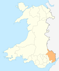
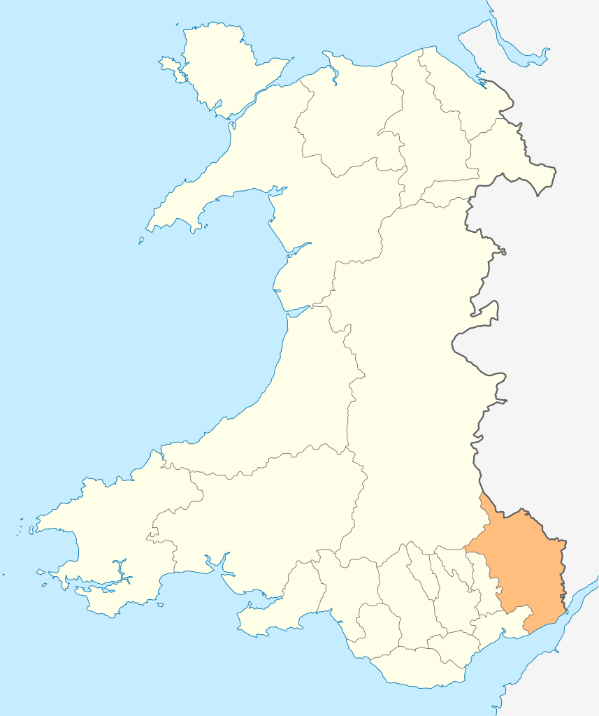
Soubor:Wales Monmouthshire locator map.svg

Velikost tohoto PNG náhledu tohoto SVG souboru: 502 × 600 pixelů. Jiná rozlišení: 201 × 240 pixelů | 402 × 480 pixelů | 643 × 768 pixelů | 857 × 1 024 pixelů | 1 714 × 2 048 pixelů | 1 047 × 1 251 pixelů.
Původní soubor (soubor SVG, nominální rozměr: 1 047 × 1 251 pixelů, velikost souboru: 149 KB)
| Tento soubor pochází z Wikimedia Commons. Níže jsou zobrazeny informace, které obsahuje jeho tamější stránka s popisem souboru. |
Popis
| Popis |
Deutsch: Lagekarte von Monmouthshire in Wales
English: Locator map of Monmouthshire in Wales |
| Datum | |
| Zdroj | Vlastní dílo |
| Autor | NordNordWest |
| Svolení (Užití tohoto souboru) |
Já, držitel autorských práv k tomuto dílu, ho tímto zveřejňuji za podmínek následující licence: Tento soubor podléhá licenci Creative Commons Uveďte autora-Zachovejte licenci 3.0 Unported
|

|
Tato mapa byla vytvořena nebo vylepšena v německé Kartenwerkstatt (Mapová laboratoř). Můžete také navrhnout mapy k vylepšení.
|
Historie souboru
Kliknutím na datum a čas se zobrazí tehdejší verze souboru.
| Datum a čas | Náhled | Rozměry | Uživatel | Komentář | |
|---|---|---|---|---|---|
| současná | 4. 5. 2010, 20:54 | | 1 047 × 1 251 (149 KB) | NordNordWest | {{int:filedesc}} {{Information |Description= {{de|Lagekarte von Monmouthshire in Wales}} {{en|Locator map of Monmouthshire in Wales}} |Source={{Own}} |Date=2010-05-04 |Author={{U|NordNordWest}} |Permission={{self|cc-by-sa-3.0}} |other_versions= }} {{Kart |
Využití souboru
Tento soubor používá následující stránka:
Globální využití souboru
Tento soubor využívají následující wiki:
- Využití na en.wikipedia.org
- Abergavenny
- Monmouth
- Usk
- Chepstow
- Monmouthshire
- Caldicot
- Caerwent
- Llanelly
- Rogiet
- List of places in Monmouthshire
- Little Mill, Monmouthshire
- Template:Monmouthshire-geo-stub
- Llanbadoc
- Wye Valley
- River Trothy
- Llanarth, Monmouthshire
- Grosmont, Monmouthshire
- Graig Syfyrddin
- Monnow Valley Walk
- Tregare
- Blaina
- Llanddewi Rhydderch
- Ashvale, Blaenau Gwent
- Govilon
- Llantilio Pertholey
- Llanvihangel Gobion
- Llangattock Lingoed
- Llanvihangel-Ystern-Llewern
- Cross Ash
- Bryngwyn
- Cwmcarvan
- Mitchel Troy
- Newbridge-on-Usk
- Mardy, Monmouthshire
- Wolvesnewton
- Llanover
- Llancayo
- Llandenny
- Llanvetherine
- Mamhilad
- Oldcastle, Monmouthshire
- Llantrisant, Monmouthshire
- Llanwenarth
- St Arvans
- Catbrook
- Glascoed
- Llansoy
- St Maughans
- Monkswood, Monmouthshire
- Llangua
Zobrazit další globální využití tohoto souboru.