
Soubor:OttomanEmpire1801.jpg
Původní soubor (1 638 × 1 296 pixelů, velikost souboru: 605 KB, MIME typ: image/jpeg)
| Tento soubor pochází z Wikimedia Commons. Níže jsou zobrazeny informace, které obsahuje jeho tamější stránka s popisem souboru. |

Popis
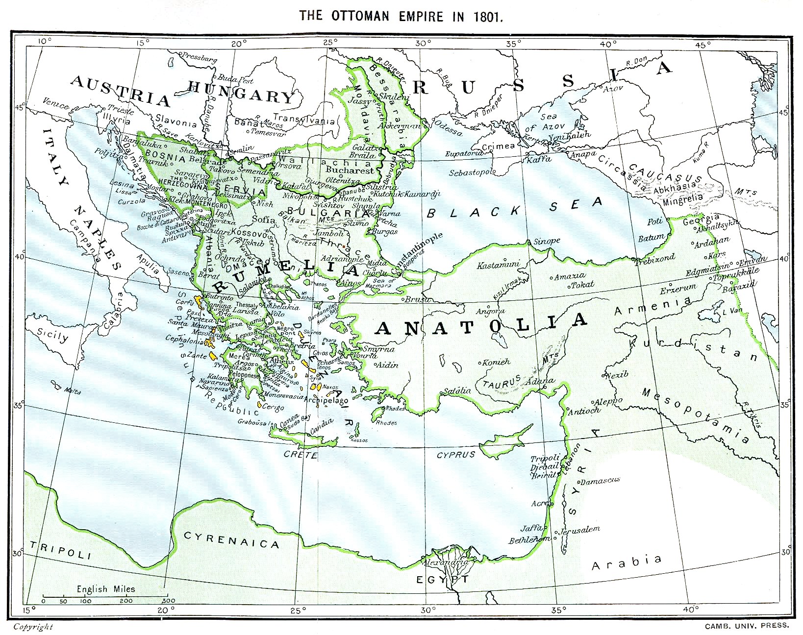
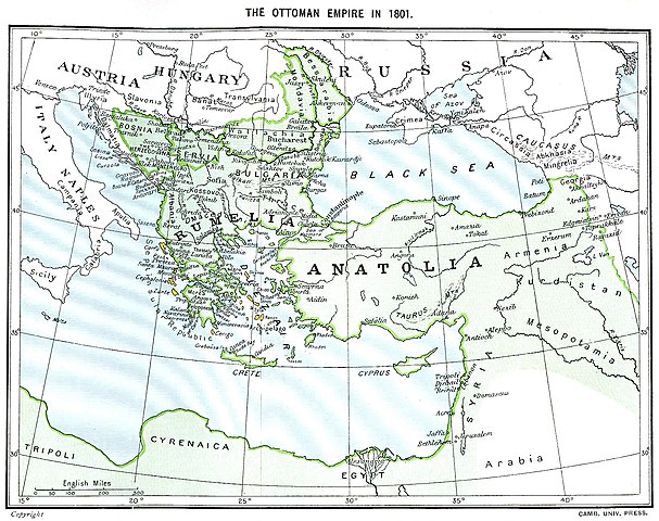
Ottoman Empire (green) and Septinsular Republic (yellow) in 1801.
Licence
|
Toto dílo je volné také v zemích, jejichž právní řád chrání majetková autorská práva po dobu života autora a 70 let po jeho smrti.
| |
| Bylo zjištěno, že u tohoto souboru nejsou známa žádná omezení daná autorským právem a právy s ním souvisejícími. | |
Historie souboru
Kliknutím na datum a čas se zobrazí tehdejší verze souboru.
| Datum a čas | Náhled | Rozměry | Uživatel | Komentář | |
|---|---|---|---|---|---|
| současná | 11. 1. 2023, 18:06 | | 1 638 × 1 296 (605 KB) | Enyavar | Reverted to version as of 08:56, 11 March 2006 (UTC) --> even if they are wrong, don't change historical maps! |
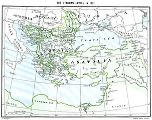
| 3. 2. 2014, 19:48 |  | 1 638 × 1 296 (518 KB) | Spiridon Ion Cepleanu | Some little changes according with the 1801 situation : The Septinsular Rep. includes Ionian Is., not the Cyclades, Serbia became autonomous 1817... | |
| 11. 3. 2006, 10:56 |  | 1 638 × 1 296 (605 KB) | Julo | Ottoman Empire (green) & Septinsular Republic (yellow) in 1801, on the 19th century map {{PD-old}} category:19th century mapsCategory:Historical maps of the Middle EastCategory:Historical maps of the Balkans[[Category:Historical maps of Africa |
Využití souboru
Tento soubor nepoužívá žádná stránka.
Globální využití souboru
Tento soubor využívají následující wiki:
- Využití na azb.wikipedia.org
- Využití na ba.wikipedia.org
- Využití na el.wikipedia.org
- Využití na fr.wikipedia.org
- Využití na hy.wikipedia.org
- Využití na la.wikipedia.org
- Využití na pl.wikipedia.org
- Využití na sq.wikipedia.org
- Využití na sv.wikipedia.org
- Využití na uk.wikipedia.org