
Soubor:Map of Russia - Southern Federal District (2018 composition).svg

Velikost tohoto PNG náhledu tohoto SVG souboru: 800 × 462 pixelů. Jiná rozlišení: 320 × 185 pixelů | 640 × 369 pixelů | 1 024 × 591 pixelů | 1 280 × 738 pixelů | 2 560 × 1 477 pixelů | 1 092 × 630 pixelů.
Původní soubor (soubor SVG, nominální rozměr: 1 092 × 630 pixelů, velikost souboru: 61 KB)
| Tento soubor pochází z Wikimedia Commons. Níže jsou zobrazeny informace, které obsahuje jeho tamější stránka s popisem souboru. |
.svg)
Popis
| Popis |
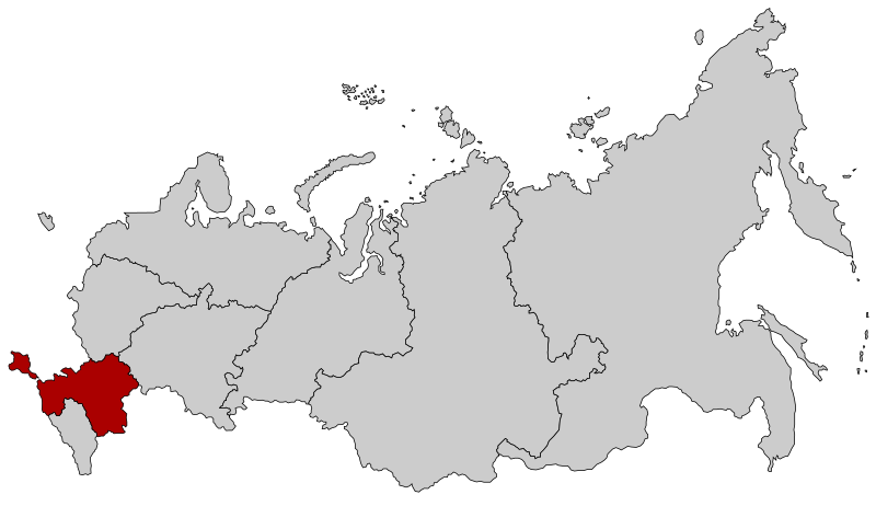
Русский: Южный федеральный округ с 28 июля 2016 года (с Крымом) с обновлением границы Дальневосточного и Сибирского ФО |
| Datum | |
| Zdroj |
Tento soubor byl odvozen z: |
| Autor |
|
.svg)
.svg)
| Toto je upravený obrázek, což znamená, že byl oproti původní verzi digitálně změněn. Úpravy: Far Eastern-Siberian border update as of November 2018. Původní verzi je možné zhlédnout zde: Map of Russia - Far Eastern Federal District (2018 composition).svg. Úpravy provedl Seryo93.
|
Licence
Tento soubor podléhá licenci Creative Commons Uveďte autora-Zachovejte licenci 2.5 Generic
- Dílo smíte:
- šířit – kopírovat, distribuovat a sdělovat veřejnosti
- upravovat – pozměňovat, doplňovat, využívat celé nebo částečně v jiných dílech
- Za těchto podmínek:
- uveďte autora – Máte povinnost uvést autorství, poskytnout odkaz na licenci a uvést, pokud jste provedli změny. Toho můžete docílit jakýmkoli rozumným způsobem, avšak ne způsobem naznačujícím, že by poskytovatel licence schvaloval nebo podporoval vás nebo vaše užití díla.
- zachovejte licenci – Pokud tento materiál jakkoliv upravíte, přepracujete nebo použijete ve svém díle, musíte své příspěvky šířit pod stejnou nebo slučitelnou licencí jako originál.
Původní historie souboru
This image is a derivative work of the following images:
- File:Map of Russia - Southern Federal District (with Crimea).svg licensed with Cc-by-sa-2.5
- 2016-07-28T15:56:06Z Seryo93 1092x630 (97541 Bytes) User created page with UploadWizard
- File:Map of Russia - Far Eastern Federal District (2018 composition).svg licensed with Cc-by-sa-2.5
- 2018-11-04T19:15:28Z Seryo93 1092x630 (62312 Bytes) == {{int:filedesc}} == {{Information |Description={{en|Map Russia highlighting the '''Far Eastern [[:en:Federal districts of Russia|Federal district]]''' as of 2018-11-03.}} {{es|Ubicación del Distrito Federal de Lejano Orie
Uploaded with derivativeFX
Historie souboru
Kliknutím na datum a čas se zobrazí tehdejší verze souboru.
| Datum a čas | Náhled | Rozměry | Uživatel | Komentář | |
|---|---|---|---|---|---|
| současná | 21. 11. 2018, 22:02 | | 1 092 × 630 (61 KB) | Seryo93 | == {{int:filedesc}} == {{Information |Description={{en|Map Russia highlighting the Southern Federal districts as of 2018-11-03.}} {{es|Ubicación del Distrito Federal Sur en la Federación Rusa}} {{Ru|Южный федеральный округ}} |Source={{Derived from|Map of Russia - Southern Federal District.svg|Map of Russia - Far Eastern Federal District (2018 composition).svg|display=50}} |Date=2018-11-21 20:01 (UTC) |Author= * [[:File:Map of Russia - Southern Federal Distr... |
Využití souboru
Tento soubor používá následující stránka:
Globální využití souboru
Tento soubor využívají následující wiki:
- Využití na en.wikinews.org
- Využití na fr.wikipedia.org
- Využití na it.wikipedia.org
- Využití na no.wikipedia.org
- Využití na ru.wikipedia.org
- Využití na zh-min-nan.wikipedia.org
.svg)