
Soubor:Karte Bundesrepublik Deutschland.svg

Velikost tohoto PNG náhledu tohoto SVG souboru: 443 × 599 pixelů. Jiná rozlišení: 177 × 240 pixelů | 355 × 480 pixelů | 567 × 768 pixelů | 757 × 1 024 pixelů | 1 513 × 2 048 pixelů | 592 × 801 pixelů.
Původní soubor (soubor SVG, nominální rozměr: 592 × 801 pixelů, velikost souboru: 108 KB)
| Tento soubor pochází z Wikimedia Commons. Níže jsou zobrazeny informace, které obsahuje jeho tamější stránka s popisem souboru. |
| Popis |
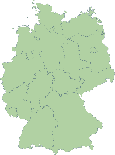
English: Germany |
| Datum | |
| Zdroj | Erstellt aus Material des gemeinsamen Datenangebotes aus dem gemeinsamen Portal der statistischen Ämter des Bundes und der Länder (DeStatis). [1] |
| Autor | Portal der statistischen Ämter des Bundes und der Länder (DeStatis); David Liuzzo. |
| Svolení (Užití tohoto souboru) |
Tento soubor podléhá licenci Creative Commons Uveďte autora-Zachovejte licenci 2.0 Německo
 |
| Další verze |
Díla odvozená od tohoto souboru: |
| SVG vývoj | Tento vektorový obrázek byl vytvořen programem Adobe Illustrator |
.svg)
Historie souboru
Kliknutím na datum a čas se zobrazí tehdejší verze souboru.
| Datum a čas | Náhled | Rozměry | Uživatel | Komentář | |
|---|---|---|---|---|---|
| současná | 14. 10. 2006, 18:59 | | 592 × 801 (108 KB) | David Liuzzo | {{Information| |Description= {{de|Karte der Bundesrepublik Deutschland mit eingezeichneten Grenzen der Bundesländer. |Source= Erstellt aus Material des gemeinsamen Datenangebotes aus dem gemeinsamen Portal der statistischen Ämter des Bundes und der Län |
Využití souboru
Tento soubor nepoužívá žádná stránka.
Globální využití souboru
Tento soubor využívají následující wiki:
- Využití na ace.wikipedia.org
- Využití na als.wikipedia.org
- Využití na ar.wikipedia.org
- Využití na az.wikipedia.org
- Využití na ban.wikipedia.org
- Využití na bg.wikipedia.org
- Využití na br.wikipedia.org
- Využití na ckb.wikipedia.org
- Využití na cy.wikipedia.org
- Využití na de.wikipedia.org
- Využití na diq.wikipedia.org
- Využití na en.wikipedia.org
Zobrazit další globální využití tohoto souboru.