
Soubor:July 2011 Thailand Flooding.jpg

Velikost tohoto náhledu: 318 × 600 pixelů. Jiná rozlišení: 127 × 240 pixelů | 254 × 480 pixelů | 407 × 768 pixelů | 543 × 1 024 pixelů | 1 086 × 2 048 pixelů | 3 780 × 7 128 pixelů.
Původní soubor (3 780 × 7 128 pixelů, velikost souboru: 4,68 MB, MIME typ: image/jpeg)
| Tento soubor pochází z Wikimedia Commons. Níže jsou zobrazeny informace, které obsahuje jeho tamější stránka s popisem souboru. |
Popis
| Popis | |
| Datum | |
| Zdroj | NASA Image of the Day |
| Autor | NASA/GSFC/METI/ERSDAC/JAROS, and U.S./Japan ASTER Science Team |
| Pozice fotografa | | Tento snímek a mnohé další na: OpenStreetMap |
|---|
Image captured by the Advanced Spaceborne Thermal Emission and Reflection Radiometer instrument on NASA's Terra spacecraft.
Licence
| This file is in the public domain in the United States because it was solely created by NASA. NASA copyright policy states that "NASA material is not protected by copyright unless noted". (See Template:PD-USGov, NASA copyright policy page or JPL Image Use Policy.) | ||
 |
Warnings:
|
Historie souboru
Kliknutím na datum a čas se zobrazí tehdejší verze souboru.
| Datum a čas | Náhled | Rozměry | Uživatel | Komentář | |
|---|---|---|---|---|---|
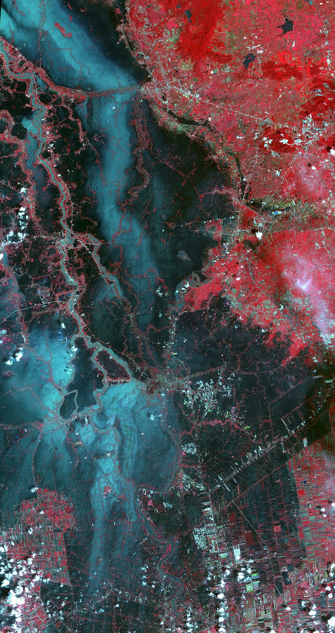
| současná | 27. 10. 2011, 17:15 | | 3 780 × 7 128 (4,68 MB) | Originalwana | {{Information |Description ={{en|1=In this image, vegetation is displayed in red, and flooded areas are black and dark blue. Brighter blue shows sediment-laden water, and gray areas are houses, [[:Category:Build |
Využití souboru
Tento soubor nepoužívá žádná stránka.
Globální využití souboru
Tento soubor využívají následující wiki:
- Využití na ilo.wikipedia.org
- Využití na incubator.wikimedia.org
- Využití na ka.wikipedia.org
- Využití na my.wikipedia.org
- Využití na sh.wikipedia.org
- Využití na te.wikipedia.org