
Soubor:Asia minor p20.jpg

Původní soubor (2 313 × 1 525 pixelů, velikost souboru: 1,07 MB, MIME typ: image/jpeg)
| Tento soubor pochází z Wikimedia Commons. Níže jsou zobrazeny informace, které obsahuje jeho tamější stránka s popisem souboru. |
Popis
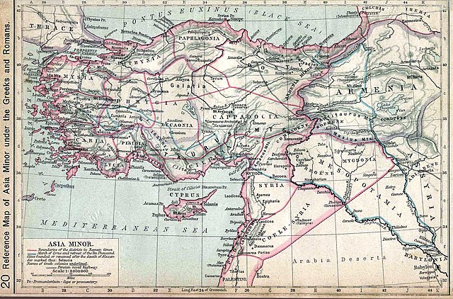
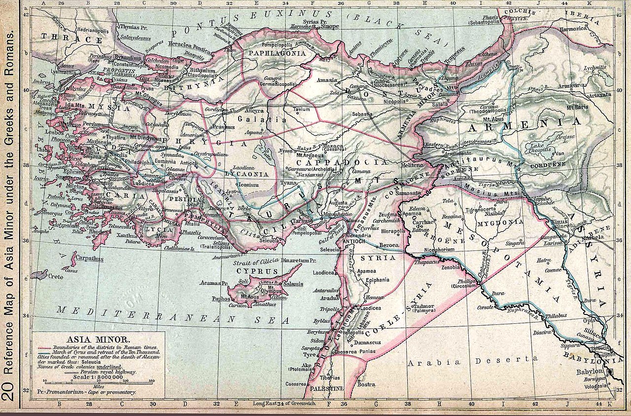
| Popis | Map of Asia Minor. Historical Atlas | ||||||||||||||||||||||
| Datum | |||||||||||||||||||||||
| Zdroj | http://www.lib.utexas.edu/maps/historical/history_shepherd_1911.html | ||||||||||||||||||||||
| Autor |
|
||||||||||||||||||||||
Licence
|
Toto dílo je volné také v zemích, jejichž právní řád chrání majetková autorská práva po dobu života autora a 70 let po jeho smrti.
| |
| Bylo zjištěno, že u tohoto souboru nejsou známa žádná omezení daná autorským právem a právy s ním souvisejícími. | |
Původní historie souboru
- 2006-06-07 09:13 Wirya 2350×1547× (406744 bytes) Asia minor under the Greeks and Romans. Map from: [http://www.lib.utexas.edu/maps/], Public Domain {{PD}}
Historie souboru
Kliknutím na datum a čas se zobrazí tehdejší verze souboru.
| Datum a čas | Náhled | Rozměry | Uživatel | Komentář | |
|---|---|---|---|---|---|
| současná | 13. 9. 2012, 06:44 | | 2 313 × 1 525 (1,07 MB) | OgreBot | (BOT): Reverting to most recent version before archival |
| 13. 9. 2012, 06:44 |  | 2 350 × 1 547 (397 KB) | OgreBot | (BOT): Uploading old version of file from en.wikipedia; originally uploaded on 2006-06-07 09:13:07 by Wirya | |
| 14. 1. 2008, 18:07 |  | 2 313 × 1 525 (1,07 MB) | Shakko | {{Information |Description=Map of Asia Minor. Historical Atlas |Source=http://www.lib.utexas.edu/maps/historical/history_shepherd_1911.html |Date=1911 |Author=en:William R. Shepherd († 1934) |Permission= |other_versions= }} Category:Cappadocia |
Využití souboru
Tento soubor používá následující stránka:
Globální využití souboru
Tento soubor využívají následující wiki:
- Využití na als.wikipedia.org
- Využití na ar.wikipedia.org
- Využití na ba.wikipedia.org
- Využití na bg.wikipedia.org
- Využití na br.wikipedia.org
- Využití na bs.wikipedia.org
- Využití na da.wikipedia.org
- Využití na de.wikipedia.org
- Využití na dsb.wikipedia.org
- Využití na el.wikipedia.org
- Využití na en.wikipedia.org
- Využití na fi.wikipedia.org
- Využití na incubator.wikimedia.org
- Využití na it.wikipedia.org
- Využití na ku.wikipedia.org
- Využití na la.wikipedia.org
- Využití na pl.wikipedia.org
- Využití na pl.wiktionary.org
- Využití na pnt.wikipedia.org
- Využití na ro.wikipedia.org
- Využití na ru.wikipedia.org
- Využití na sh.wikipedia.org
- Využití na sl.wikipedia.org
- Využití na sr.wikipedia.org
- Využití na ta.wikipedia.org
- Využití na tr.wikipedia.org
Zobrazit další globální využití tohoto souboru.