
Soubor:Path of the Wounded history sign 7 History infoboard.JPG

Původní soubor (4 608 × 3 072 pixelů, velikost souboru: 7,33 MB, MIME typ: image/jpeg)
| Tento soubor pochází z Wikimedia Commons. Níže jsou zobrazeny informace, které obsahuje jeho tamější stránka s popisem souboru. |
Popis
| Popis |
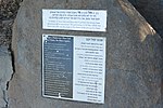
Deutsch: Oberes Schild:
Schild darunter:
English: Top sign:
The secong sign beyond:
|
| Datum | |
| Zdroj | Vlastní dílo |
| Autor | Jotpe |
| Place[1] | Deutsch: 9977, Galil Elyon Regional Council, Nordbezirk, Israel English: 9977, Galil Elyon Regional Council, North District, Israel עברית: 9977, מועצה אזורית גליל עליון, מחוז הצפון, ישראל |
| Image Number | 74 |
| Height | 264 |
| Pozice fotografa | | Tento snímek a mnohé další na: OpenStreetMap |
|---|
-
 Path of the Wounded history sign 6 Reestablishing settlements.JPG
 -
 Path of the Wounded history sign 7 History infoboard.JPG
 -
 Path of the Wounded history sign 8 Drawing courtyard.JPG
 -
 Kiryat Shmona northern view.JPG
 -
 Kiryat Shmona northern view 2.JPG
 -
 Path of the Wounded history sign 5 Youth groups in Tel Hai.JPG


The production, editing or release of this file was supported by the Community-Budget of Wikimedia Deutschland. To see other files made with the support of Wikimedia Deutschland, please see the category Supported by Wikimedia Deutschland. |
Licence
- Dílo smíte:
- šířit – kopírovat, distribuovat a sdělovat veřejnosti
- upravovat – pozměňovat, doplňovat, využívat celé nebo částečně v jiných dílech
- Za těchto podmínek:
- uveďte autora – Máte povinnost uvést autorství, poskytnout odkaz na licenci a uvést, pokud jste provedli změny. Toho můžete docílit jakýmkoli rozumným způsobem, avšak ne způsobem naznačujícím, že by poskytovatel licence schvaloval nebo podporoval vás nebo vaše užití díla.
- zachovejte licenci – Pokud tento materiál jakkoliv upravíte, přepracujete nebo použijete ve svém díle, musíte své příspěvky šířit pod stejnou nebo slučitelnou licencí jako originál.
Sources
Historie souboru
Kliknutím na datum a čas se zobrazí tehdejší verze souboru.
| Datum a čas | Náhled | Rozměry | Uživatel | Komentář | |
|---|---|---|---|---|---|
| současná | 2. 2. 2015, 07:17 | | 4 608 × 3 072 (7,33 MB) | Jotpe |
Využití souboru
Tento soubor nepoužívá žádná stránka.