
Soubor:TierraDelFuego Satellite1.jpg

Velikost tohoto náhledu: 763 × 600 pixelů. Jiná rozlišení: 306 × 240 pixelů | 611 × 480 pixelů | 978 × 768 pixelů | 1 280 × 1 006 pixelů | 2 560 × 2 011 pixelů | 2 800 × 2 200 pixelů.
Původní soubor (2 800 × 2 200 pixelů, velikost souboru: 954 KB, MIME typ: image/jpeg)
| Tento soubor pochází z Wikimedia Commons. Níže jsou zobrazeny informace, které obsahuje jeho tamější stránka s popisem souboru. |
Popis
| Popis |
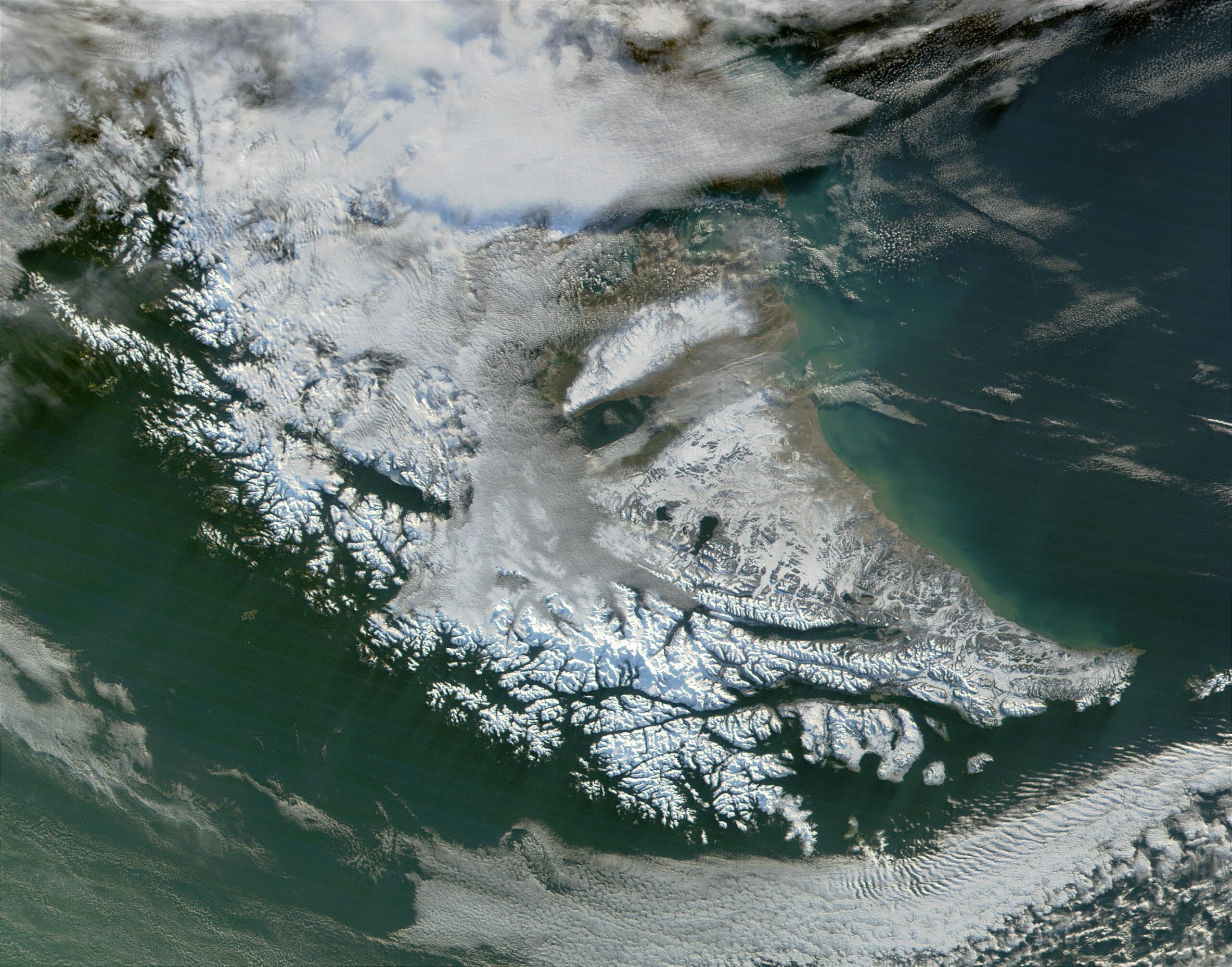
English: Satellite image of Tierra del Fuego. Very cloudy and snowy because this picture was taken during the southern hemisphere's autumn. |
| Datum | |
| Zdroj | http://visibleearth.nasa.gov/view_rec.php?id=1949 |
| Autor | Jacques Descloitres, MODIS Land Rapid Response Team |
Licence
| This file is in the public domain in the United States because it was solely created by NASA. NASA copyright policy states that "NASA material is not protected by copyright unless noted". (See Template:PD-USGov, NASA copyright policy page or JPL Image Use Policy.) | ||
 |
Warnings:
|
Historie souboru
Kliknutím na datum a čas se zobrazí tehdejší verze souboru.
| Datum a čas | Náhled | Rozměry | Uživatel | Komentář | |
|---|---|---|---|---|---|
| současná | 10. 8. 2010, 22:51 | | 2 800 × 2 200 (954 KB) | IdLoveOne~commonswiki | {{Information |Description={{en|1=Satellite image of Tierra del Fuego}} |Source=http://visibleearth.nasa.gov/view_rec.php?id=1949 |Author=Jacques Descloitres, MODIS Land Rapid Response Team |Date=2006-06-08 |Permission= |oth |
Využití souboru
Tento soubor používá následující stránka:
Globální využití souboru
Tento soubor využívají následující wiki:
- Využití na ast.wikipedia.org
- Využití na es.wikipedia.org
- Využití na he.wikipedia.org
- Využití na pl.wikipedia.org
- Využití na pt.wikipedia.org
- Využití na sr.wikipedia.org