
Soubor:Spratly Is since NalGeoMaps.png
Větší rozlišení není k dispozici
Spratly_Is_since_NalGeoMaps.png (330 × 354 pixelů, velikost souboru: 31 KB, MIME typ: image/png)
| Tento soubor pochází z Wikimedia Commons. Níže jsou zobrazeny informace, které obsahuje jeho tamější stránka s popisem souboru. |

|
Tento obrázek (skupina locator map) by měl být vytvořen pomocí vektorové grafiky jako SVG soubor. To má několik výhod; podrobnosti najdete na stránce Commons:Media for cleanup. Je-li SVG verze tohoto obrázku již k dispozici, prosím nahrajte ji. Po nahrání nahraďte tuto šablonu šablonou {{Vector version available|jméno nového obrázku.svg}}.
|
Popis
| Popis |
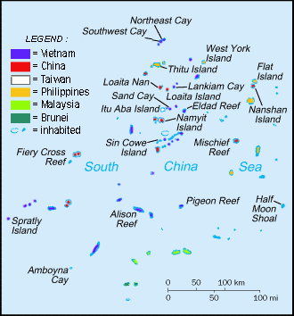
English: Spratly Islands military settlements
Français : Etablissements militaires dans l'archipel des Spratly
Tagalog: Sakop na lupa ng militar sa Pulo ng Kalayaan
中文(简体):南沙群岛的军事区
中文(繁體):南沙群島的軍事區 |
| Datum | |
| Zdroj | Cartothèque Spiridon Manoliu |
| Autor | Spiridon Manoliu |
Licence
| Já, autor tohoto díla, jej tímto uvolňuji jako volné dílo, a to celosvětově. V některých zemích to není podle zákona možné; v takovém případě: Poskytuji komukoli právo užívat toto dílo za libovolným účelem, a to bezpodmínečně s výjimkou podmínek vyžadovaných zákonem. |
Historie souboru
Kliknutím na datum a čas se zobrazí tehdejší verze souboru.
| Datum a čas | Náhled | Rozměry | Uživatel | Komentář | |
|---|---|---|---|---|---|
| současná | 12. 3. 2021, 08:50 | | 330 × 354 (31 KB) | Mlgc1998 | typo |
| 13. 4. 2015, 13:46 |  | 330 × 354 (18 KB) | RokerHRO | optipng -o7 -i0 → 42.83% decrease | |
| 29. 3. 2009, 16:05 |  | 330 × 354 (32 KB) | Spiridon Ion Cepleanu | {{Information |Description={{en|1=Spratley Islands military settlements}} {{fr|1=Etablissements militaires dans l'archipel des Spratly}} |Source=Cartothèque Spiridon Manoliu |Author=Spiridon Manoliu |Date=March 29, 2009 |Permission= |other_versions= }} |
Využití souboru
Tento soubor používá následující stránka:
Globální využití souboru
Tento soubor využívají následující wiki:
- Využití na bcl.wikipedia.org
- Využití na br.wikipedia.org
- Využití na el.wikipedia.org
- Využití na en.wikipedia.org
- Spratly Islands
- Exclusive economic zone
- Republic of Morac-Songhrati-Meads
- East Sea Campaign
- Philippines and the Spratly Islands
- Template:Spratly Islands
- Spratly Islands dispute
- Dangerous Ground (South China Sea)
- List of maritime features in the Spratly Islands
- List of airports in the Spratly Islands
- DK1 rigs
- Great Wall of Sand
- Využití na en.wikinews.org
- Využití na en.wikivoyage.org
- Využití na fa.wikipedia.org
- Využití na fi.wikipedia.org
- Využití na fr.wikipedia.org
- Využití na fr.wiktionary.org
- Využití na gl.wikipedia.org
- Využití na hi.wikipedia.org
- Využití na id.wikipedia.org
- Využití na io.wikipedia.org
- Využití na ja.wikipedia.org
- Využití na ko.wikipedia.org
- Využití na no.wikipedia.org
- Využití na pt.wikipedia.org
- Využití na sv.wikipedia.org
- Využití na th.wikipedia.org
- Využití na tr.wikipedia.org
- Využití na ug.wikipedia.org
- Využití na vi.wikipedia.org