
Soubor:Rynok Square in Lviv (8673864339).jpg
Původní soubor (4 288 × 2 848 pixelů, velikost souboru: 3,13 MB, MIME typ: image/jpeg)
| Tento soubor pochází z Wikimedia Commons. Níže jsou zobrazeny informace, které obsahuje jeho tamější stránka s popisem souboru. |
.jpg)
Popis
| Popis |
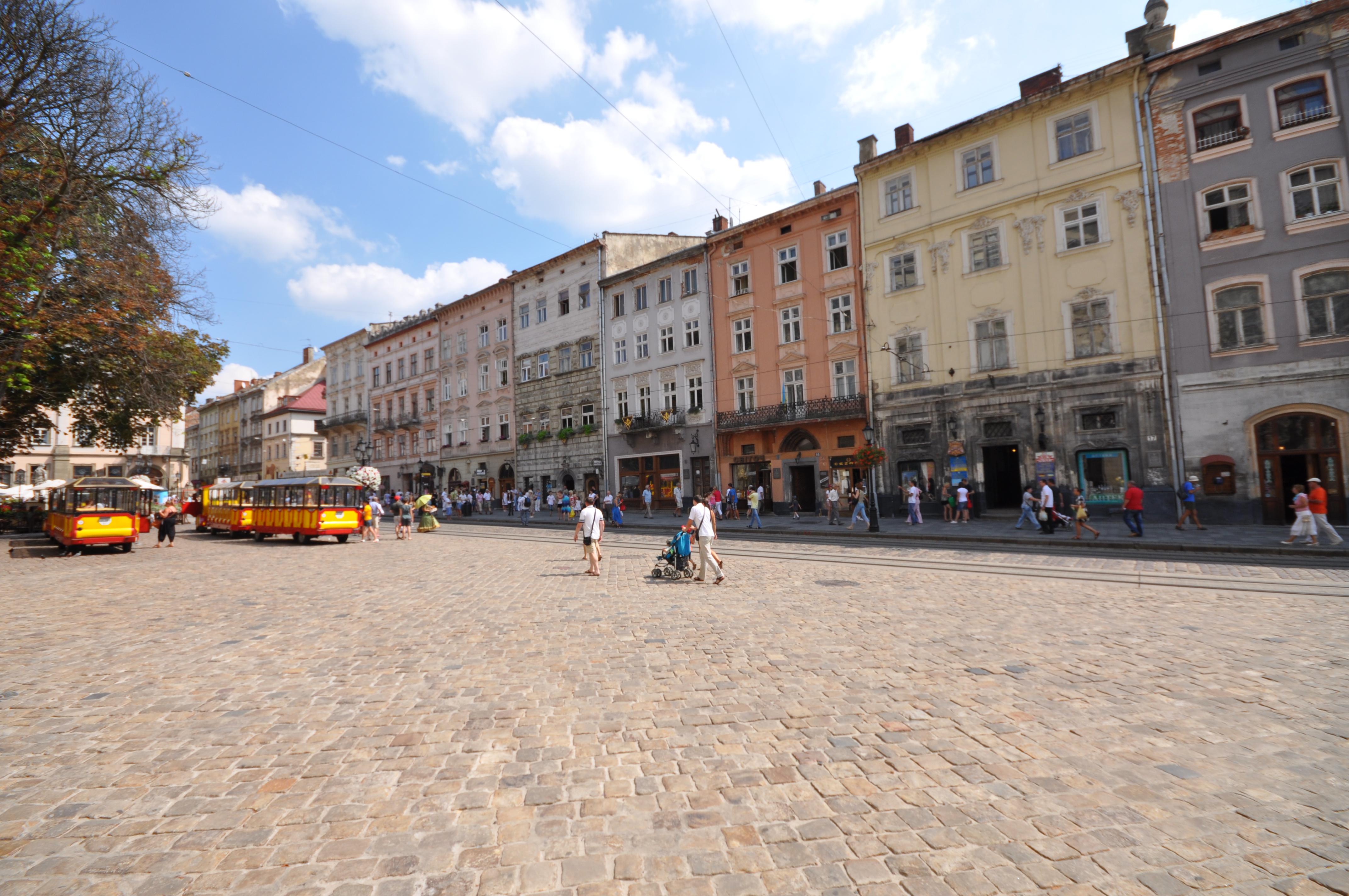
The Rynok Square in Lviv is a central square of the city of Lviv, Ukraine. It was planned in the second half of the 14th century, following granting city rights by Polish king Casimir III, who annexed Red Ruthenia. The king ordered Lviv to be moved more to the south, where a new city was built to the plan of a traditional European settlement: a central square surrounded by living quarters and fortifications. Old, Ruthenian Lviv had become a suburb of the new city. The square is rectangular in shape, with measurements of 142 meters by 129 meters and with two streets radiating out of every corner. In the middle there was a row of houses, with its southern wall made by the Town Hall. However, when in 1825 the tower of the Town Hall burned, all adjacent houses were demolished and a new hall, with a 65-meter tower, was built in 1835 by architects J. Markl and F. Trescher. Around the square, there are 44 tenement houses, which represent several architectural styles, from Renaissance to Modernism. In the four corners, there are fountains—wells from 1793, probably designed by Hartman Witwer. The sculptures represent four Greek mythological figures: Neptune, Diana, Amphitrite and Adonis. In front of the Town Hall, there was a pillory. In 1998 the Market Place, together with the historic city center of Lviv, was recognized as a UNESCO world heritage site [Wikipedia.org] |
| Datum | |
| Zdroj |
|
| Autor | Jorge Láscar from Australia |
| Pozice fotografa | | Tento snímek a mnohé další na: OpenStreetMap |
|---|
.jpg¶ms=049.841466_N_0024.031265_E_globe:Earth_type:camera_source:Flickr_&language=cs)
Licence
- Dílo smíte:
- šířit – kopírovat, distribuovat a sdělovat veřejnosti
- upravovat – pozměňovat, doplňovat, využívat celé nebo částečně v jiných dílech
- Za těchto podmínek:
- uveďte autora – Máte povinnost uvést autorství, poskytnout odkaz na licenci a uvést, pokud jste provedli změny. Toho můžete docílit jakýmkoli rozumným způsobem, avšak ne způsobem naznačujícím, že by poskytovatel licence schvaloval nebo podporoval vás nebo vaše užití díla.
| Tento obrázek, který byl původně zveřejněn na Flickru, zkontroloval 10. srpna 2013 správce nebo kontrolor File Upload Bot (Magnus Manske) a potvrdil, že je na Flickru dostupný pod správnou licencí. |
Historie souboru
Kliknutím na datum a čas se zobrazí tehdejší verze souboru.
| Datum a čas | Náhled | Rozměry | Uživatel | Komentář | |
|---|---|---|---|---|---|
| současná | 10. 8. 2013, 16:20 | | 4 288 × 2 848 (3,13 MB) | File Upload Bot (Magnus Manske) | Transferred from Flickr by User:High Contrast |
Využití souboru
Tento soubor používá následující stránka:
.jpg)