
Soubor:Mark Meißen und Lausitz um 1600, Bartholomäus Scultetus.jpg

Původní soubor (1 406 × 1 999 pixelů, velikost souboru: 627 KB, MIME typ: image/jpeg)
| Tento soubor pochází z Wikimedia Commons. Níže jsou zobrazeny informace, které obsahuje jeho tamější stránka s popisem souboru. |
Popis
| Popis |
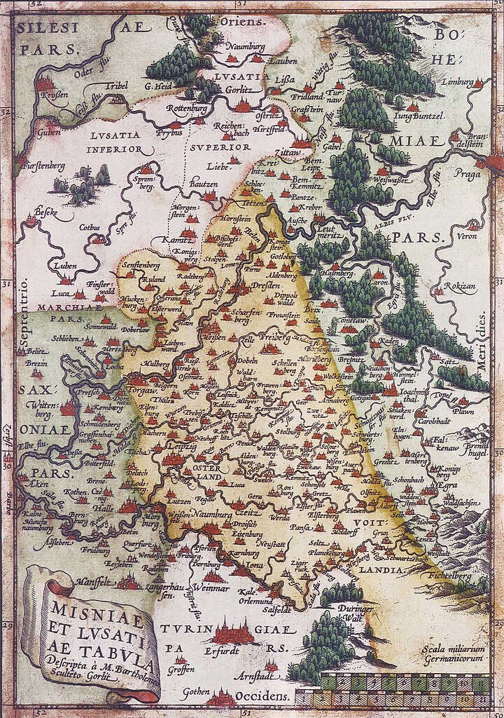
Deutsch: Karte der Mark Meißen und der Lausitz um 1600; Norden ist links und die Blickrichtung geht von West nach Ost. English: Map of Meissen an Lusatia around 1600; North to the left |
||||||||||||||||||||
| Datum | cca 1600 | ||||||||||||||||||||
| Zdroj | |||||||||||||||||||||
| Autor |
|
||||||||||||||||||||
| Další verze |
 |
||||||||||||||||||||

Licence
|
Toto dílo je volné také v zemích, jejichž právní řád chrání majetková autorská práva po dobu života autora a 70 let po jeho smrti.
| |
| Bylo zjištěno, že u tohoto souboru nejsou známa žádná omezení daná autorským právem a právy s ním souvisejícími. | |
Historie souboru
Kliknutím na datum a čas se zobrazí tehdejší verze souboru.
| Datum a čas | Náhled | Rozměry | Uživatel | Komentář | |
|---|---|---|---|---|---|
| současná | 26. 3. 2006, 18:36 | | 1 406 × 1 999 (627 KB) | Torsten Schleese | Karte der Mark Meíßen und der Lausitz um 1600 Category:Torsten Schleese {{PD-old}} |
Využití souboru
Tento soubor používá následující stránka:
Globální využití souboru
Tento soubor využívají následující wiki:
- Využití na be.wikipedia.org
- Využití na bg.wikipedia.org
- Využití na de.wikipedia.org
- Využití na it.wikipedia.org
- Využití na pl.wikipedia.org
- Využití na ru.wikipedia.org
- Využití na uk.wikipedia.org