
Soubor:Location of Isauria-Asia Minor Map, Classical Atlas, 1886, Keith Johnston.jpg
Location_of_Isauria-Asia_Minor_Map,_Classical_Atlas,_1886,_Keith_Johnston.jpg (637 × 340 pixelů, velikost souboru: 112 KB, MIME typ: image/jpeg)
| Tento soubor pochází z Wikimedia Commons. Níže jsou zobrazeny informace, které obsahuje jeho tamější stránka s popisem souboru. |
| Popis |
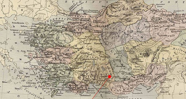
English: Asia Minor.
|
| Datum | (UTC) |
| Zdroj | |
| Autor |
|
| Toto je upravený obrázek, což znamená, že byl oproti původní verzi digitálně změněn. Úpravy: Cropping and red pointer added to show location of Isauria. Původní verzi je možné zhlédnout zde: Asia Minor Map, Classical Atlas, 1886, Keith Johnston.jpg. Úpravy provedl Polylerus.
|
|
Toto dílo je volné také v zemích, jejichž právní řád chrání majetková autorská práva po dobu života autora a 70 let po jeho smrti.
| |
| Bylo zjištěno, že u tohoto souboru nejsou známa žádná omezení daná autorským právem a právy s ním souvisejícími. | |
Původní historie souboru
This image is a derivative work of the following images:
- File:Asia_Minor_Map,_Classical_Atlas,_1886,_Keith_Johnston.jpg licensed with Cc-pd-mark-footer, PD-old
- 2009-12-03T21:05:42Z Jssfrk 3669x2824 (938691 Bytes) {{Information |Description={{en|1=Asia Minor. Including Pontus, Cappadocia, Cilicia, Pisidia, Lycia, Caria, Lydia, Mysia, Bithynia, Paphlagonia, Phrygia, and Crete. "These color maps are 11" x 13.5" when printed at 300dpi. T
Uploaded with derivativeFX
Historie souboru
Kliknutím na datum a čas se zobrazí tehdejší verze souboru.
| Datum a čas | Náhled | Rozměry | Uživatel | Komentář | |
|---|---|---|---|---|---|
| současná | 24. 1. 2011, 01:23 | | 637 × 340 (112 KB) | Polylerus | {{Information |Description={{en|1=Asia Minor. Including Pontus, Cappadocia, Cilicia, Pisidia, Lycia, Caria, Lydia, Mysia, Bithynia, Paphlagonia, Phrygia, and Crete. "These color maps are 11" x 13.5" when printed at 300dpi. They were copied from an origin |
Využití souboru
Tento soubor používá následující stránka:
Globální využití souboru
Tento soubor využívají následující wiki:
- Využití na bcl.wikipedia.org
- Využití na de.wikipedia.org
- Využití na en.wikipedia.org
- Využití na es.wikipedia.org
- Využití na eu.wikipedia.org
- Využití na hy.wikipedia.org
- Využití na id.wikipedia.org
- Využití na pl.wikipedia.org
- Využití na pt.wikipedia.org
- Využití na ro.wikipedia.org
- Využití na sh.wikipedia.org
- Využití na sl.wikipedia.org
- Využití na tr.wikipedia.org