
Soubor:Lake Pontchartrain Causeway south.jpg
Velikost tohoto náhledu: 800 × 534 pixelů. Jiná rozlišení: 320 × 214 pixelů | 640 × 427 pixelů | 1 024 × 683 pixelů | 1 500 × 1 001 pixelů.
Původní soubor (1 500 × 1 001 pixelů, velikost souboru: 281 KB, MIME typ: image/jpeg)
| Tento soubor pochází z Wikimedia Commons. Níže jsou zobrazeny informace, které obsahuje jeho tamější stránka s popisem souboru. |
| Popis |
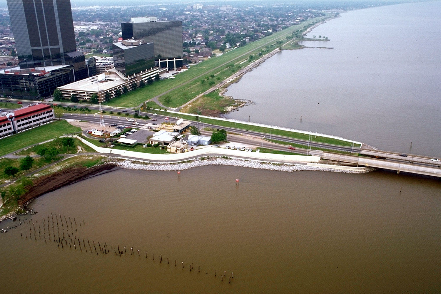
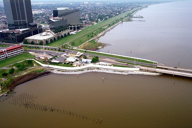
English: The southern end of the Lake Pontchartrain Causeway at Metairie, Louisiana, USA. View is to the southwest near Causeway Boulevard, Metairie. |
|||
| Datum | ||||
| Zdroj |
U.S. Army Corps of Engineers Digital Visual Library Image page Image description page Digital Visual Library home page |
|||
| Autor | Arthur Belala, U.S. Army Corps of Engineers | |||
| Svolení (Užití tohoto souboru) |
|
|||
| Umístění | New Orleans, Louisiana, USA |
| Pozice fotografa | | Tento snímek a mnohé další na: OpenStreetMap |
|---|
Historie souboru
Kliknutím na datum a čas se zobrazí tehdejší verze souboru.
| Datum a čas | Náhled | Rozměry | Uživatel | Komentář | |
|---|---|---|---|---|---|
| současná | 1. 4. 2007, 18:59 | | 1 500 × 1 001 (281 KB) | DanMS | {{Information | Description = {{en|The southern end of the Lake Pontchartrain Causeway at New Orleans, Louisiana, USA. View is to the southwest over New Orleans.}} | Source = U.S. Army Corps of Engineers Digital Visual Library<br />[http://imag |
Využití souboru
Tento soubor používá následující stránka:
Globální využití souboru
Tento soubor využívají následující wiki:
- Využití na ar.wikipedia.org
- Využití na el.wikipedia.org
- Využití na en.wikipedia.org
- Využití na es.wikipedia.org
- Využití na fa.wikipedia.org
- Využití na fi.wikipedia.org
- Využití na fr.wikipedia.org
- Využití na id.wikipedia.org
- Využití na it.wikipedia.org
- Využití na nl.wikipedia.org
- Využití na pl.wikipedia.org
- Využití na pt.wikipedia.org
- Využití na sk.wikipedia.org
- Využití na sr.wikipedia.org
- Využití na sw.wikipedia.org
- Využití na tr.wikipedia.org
- Využití na uk.wikipedia.org
- Využití na uz.wikipedia.org
- Využití na vi.wikipedia.org
- Využití na zh-yue.wikipedia.org