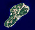
Soubor:EO1 ALI Lamay Island.jpg
EO1_ALI_Lamay_Island.jpg (530 × 455 pixelů, velikost souboru: 227 KB, MIME typ: image/jpeg)
Historie souboru
Kliknutím na datum a čas se zobrazí tehdejší verze souboru.
| Datum a čas | Náhled | Rozměry | Uživatel | Komentář | |
|---|---|---|---|---|---|
| současná | 17. 10. 2014, 09:35 |  | 530 × 455 (227 KB) | Philipxd | CROP BLACK STRIP |
| 17. 10. 2014, 09:34 |  | 799 × 664 (271 KB) | Philipxd | crop black strip | |
| 30. 8. 2012, 05:18 |  | 799 × 664 (271 KB) | Macos8 | {{Information |Description ={{en|1=The Advanced Land Imager (ALI) on NASA’s Earth Observing-1 satellite captured this image of Lamay Island offshore southwestern Taiwan. This 10-meter resolution false-colored image shows the old airstrip has been ... |
Využití souboru
Tento soubor používá následující stránka:
Globální využití souboru
Tento soubor využívají následující wiki:
- Využití na ceb.wikipedia.org
- Využití na en.wikipedia.org
- Využití na fa.wikipedia.org
- Využití na fi.wikipedia.org
- Využití na fr.wikipedia.org
- Využití na it.wikipedia.org
- Využití na lld.wikipedia.org
- Využití na www.wikidata.org
- Využití na zh-yue.wikipedia.org
- Využití na zh.wikipedia.org
- Využití na zh.wikivoyage.org


