
Soubor:Derbyshire UK location map.svg

Velikost tohoto PNG náhledu tohoto SVG souboru: 406 × 599 pixelů. Jiná rozlišení: 162 × 240 pixelů | 325 × 480 pixelů | 520 × 768 pixelů | 693 × 1 024 pixelů | 1 387 × 2 048 pixelů | 884 × 1 305 pixelů.
Původní soubor (soubor SVG, nominální rozměr: 884 × 1 305 pixelů, velikost souboru: 2,38 MB)
| Tento soubor pochází z Wikimedia Commons. Níže jsou zobrazeny informace, které obsahuje jeho tamější stránka s popisem souboru. |
| Popis |
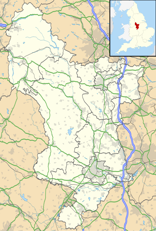
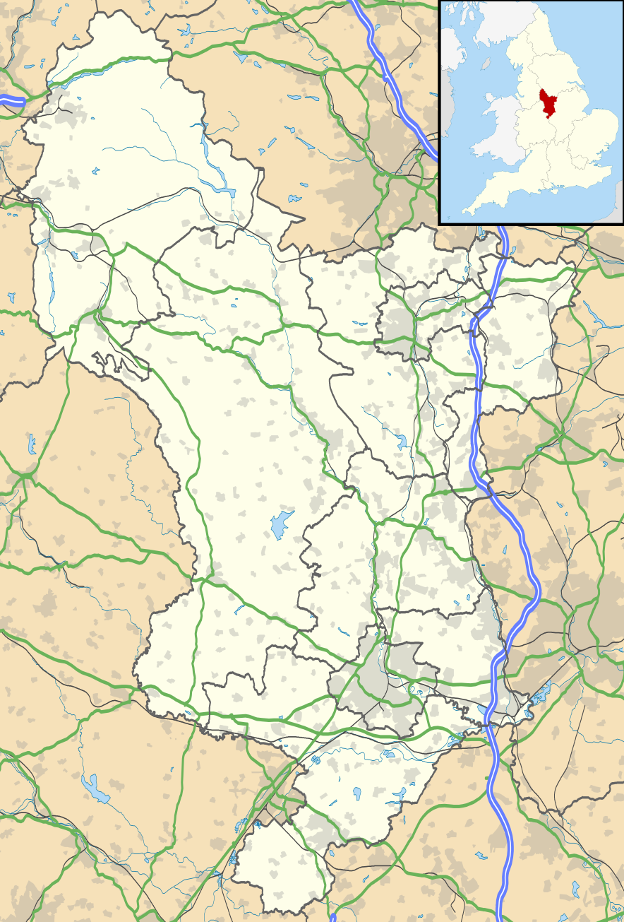
Map of Derbyshire, UK with the following information shown:
Equirectangular map projection on WGS 84 datum, with N/S stretched 165% Geographic limits:
|
| Datum | |
| Zdroj |
|
| Autor | Nilfanion, created using Ordnance Survey data |
| Svolení (Užití tohoto souboru) |
Tento soubor podléhá licenci Creative Commons Uveďte autora-Zachovejte licenci 3.0 Unported Uveďte autora: Contains Ordnance Survey data © Crown copyright and database right
|
| Další verze | File:Devon UK district map (blank).svg - Blank map |
.svg)
Historie souboru
Kliknutím na datum a čas se zobrazí tehdejší verze souboru.
| Datum a čas | Náhled | Rozměry | Uživatel | Komentář | |
|---|---|---|---|---|---|
| současná | 26. 9. 2010, 20:46 | | 884 × 1 305 (2,38 MB) | Nilfanion | {{Information |Description=Map of Derbyshire, UK with the following information shown: *Administrative borders *Coastline, lakes and rivers *Roads and railways *Urban areas Equirectangular map projection on WGS 84 datum, with N/S stretch |
Využití souboru
Tento soubor používá následující stránka:
Globální využití souboru
Tento soubor využívají následující wiki:
- Využití na ar.wikipedia.org
- Využití na bg.wikipedia.org
- Využití na ca.wikipedia.org
- Využití na ceb.wikipedia.org
- Využití na cy.wikipedia.org
- Využití na el.wikipedia.org
- Využití na en.wikipedia.org
- Derbyshire
- Chatsworth House
- Kedleston Hall
- Staveley, Derbyshire
- Glossop
- Buxton
- Calke Abbey
- Sudbury Hall
- Bolsover Castle
- Chesterfield, Derbyshire
- Thornhill, Derbyshire
- Newhaven, Derbyshire
- Gamesley
- Bretby Hall
- Birchinlee
- Ripley, Derbyshire
- Repton
- Eyam
- Edale
- Castleton, Derbyshire
- Hope, Derbyshire
- Hathersage
- Spondon
- Matlock, Derbyshire
- Matlock Bath
- Bolsover
- Ashbourne, Derbyshire
- Alfreton
- Heanor
- Pleasley
- Wirksworth
- Leam, Derbyshire
- Ilkeston
- Heage
- New Mills
- Long Eaton
- Littleover
- Mickleover
- Dronfield
- Tideswell
- Hartington, Derbyshire
- Youlgreave
Zobrazit další globální využití tohoto souboru.