
Soubor:Carte de ukraine 1919.jpg

Velikost tohoto náhledu: 800 × 508 pixelů. Jiná rozlišení: 320 × 203 pixelů | 640 × 406 pixelů | 934 × 593 pixelů.
Původní soubor (934 × 593 pixelů, velikost souboru: 305 KB, MIME typ: image/jpeg)
| Tento soubor pochází z Wikimedia Commons. Níže jsou zobrazeny informace, které obsahuje jeho tamější stránka s popisem souboru. |
Popis
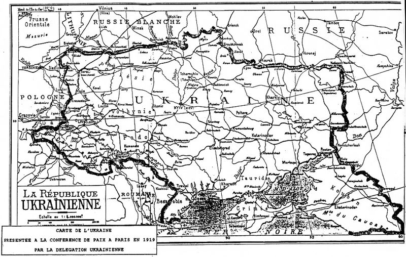
| Popis |
Deutsch: Grenzziehung der Ukrainischen Republik, wie sie von der ukrainischen Delegation auf der Pariser Friedenskonferenz 1919 präsentiert wurde
English: Map of Ukraine presented by Ukrainian delegation on Paris Peace Conference, 1919
Українська: Межі України, які були заявлені делегацією УНР на Паризькій мирній конференції в 1919-20 рр. |
| Datum | 1919 |
| Zdroj | direct source:Documents of Paris Peace Conference 1919 see also :"Akten zur deutschen auswärtigen Politik 1918-1945" Ser. A, 1918-1925. Bd. 1, 9. November bis 5. Mai 1919 Göttingen : Vandenhoeck und Ruprecht, 1982. |
| Autor | Government of ZUNR in name of ZUNR and UNR, official document of government of Ukraine |
| Další verze |
|


Licence
This file is a Ukrainian or Ukrainian SSR work and it is presently in the public domain in Ukraine, because it was published before January 1, 1954, and the creator (if known) died before that date (details).
|
 |
Historie souboru
Kliknutím na datum a čas se zobrazí tehdejší verze souboru.
| Datum a čas | Náhled | Rozměry | Uživatel | Komentář | |
|---|---|---|---|---|---|
| současná | 2. 10. 2011, 02:48 | | 934 × 593 (305 KB) | Yerevanci | better version |
| 8. 3. 2008, 03:49 |  | 934 × 593 (194 KB) | Riwnodennyk | {{Information |Description={{en|Map of Ukraine perposed by Ukrainian delegation on Paris Peace Conference, 1919}} |Source=[http://uk.wikipedia.org/wiki/Зображення:Carte_de_ukraine_1919.jpg Ukrainian Wikipedia] |
Využití souboru
Tento soubor nepoužívá žádná stránka.
Globální využití souboru
Tento soubor využívají následující wiki:
- Využití na be-tarask.wikipedia.org
- Využití na et.wikipedia.org