
Soubor:Bangor, View on Suspension Bridge (8571590364).jpg
Velikost tohoto náhledu: 800 × 554 pixelů. Jiná rozlišení: 320 × 222 pixelů | 640 × 444 pixelů | 1 000 × 693 pixelů.
Původní soubor (1 000 × 693 pixelů, velikost souboru: 528 KB, MIME typ: image/jpeg)
| Tento soubor pochází z Wikimedia Commons. Níže jsou zobrazeny informace, které obsahuje jeho tamější stránka s popisem souboru. |
.jpg)
Popis
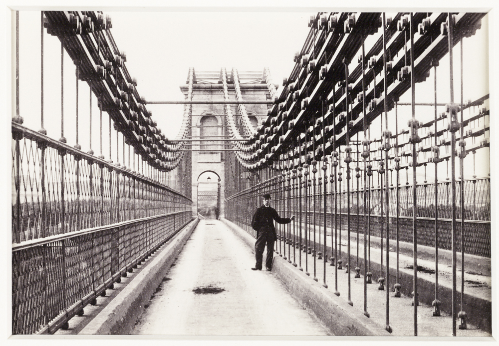
| Popis | Creator: Francis Bedford (1816 - 1894) Date: c. 1880 Format: Albumen print Collection: National Media Museum Collection Inventory no: 1990-5037_B1_0997 A photographic view across the Menai suspension bridge in Bangor, North Wales. Built by one of England's greatest civil engineers, Thomas Telford (1757 - 1834), construction began in 1819 and the bridge opened for traffic in 1826. It crosses the Menai Straits between Bangor and Anglesey. |
| Zdroj |
'Bangor, View on Suspension Bridge'
|
| Autor | National Media Museum from UK |
| Svolení (Užití tohoto souboru) |
National Media Museum @ Flickr Commons |
| Pozice fotografa | | Tento snímek a mnohé další na: OpenStreetMap |
|---|
.jpg¶ms=053.220424_N_-004.163818_E_globe:Earth_type:camera_source:Flickr_&language=cs)
Licence
This image was taken from Flickr's The Commons. The uploading organization may have various reasons for determining that no known copyright restrictions exist, such as:
More information can be found at https://flickr.com/commons/usage/. Please add additional copyright tags to this image if more specific information about copyright status can be determined. See Commons:Licensing for more information. |
| Tento obrázek, který byl původně zveřejněn na Flickru, zkontroloval 20. května 2013 správce nebo kontrolor File Upload Bot (Magnus Manske) a potvrdil, že je na Flickru dostupný pod správnou licencí. |
Historie souboru
Kliknutím na datum a čas se zobrazí tehdejší verze souboru.
| Datum a čas | Náhled | Rozměry | Uživatel | Komentář | |
|---|---|---|---|---|---|
| současná | 20. 5. 2013, 17:49 | | 1 000 × 693 (528 KB) | File Upload Bot (Magnus Manske) | Transferred from Flickr by User:mrjohncummings |
Využití souboru
Tento soubor používá následující stránka:
Globální využití souboru
Tento soubor využívají následující wiki:
- Využití na en.wikipedia.org
- Využití na et.wikipedia.org
- Využití na fr.wikipedia.org
- Využití na fr.wikibooks.org
- Využití na nl.wikipedia.org
.jpg)