
Soubor:Asia Minor Map, Classical Atlas, 1886, Keith Johnston.jpg

Původní soubor (3 669 × 2 824 pixelů, velikost souboru: 917 KB, MIME typ: image/jpeg)
| Tento soubor pochází z Wikimedia Commons. Níže jsou zobrazeny informace, které obsahuje jeho tamější stránka s popisem souboru. |
Popis
| Popis |
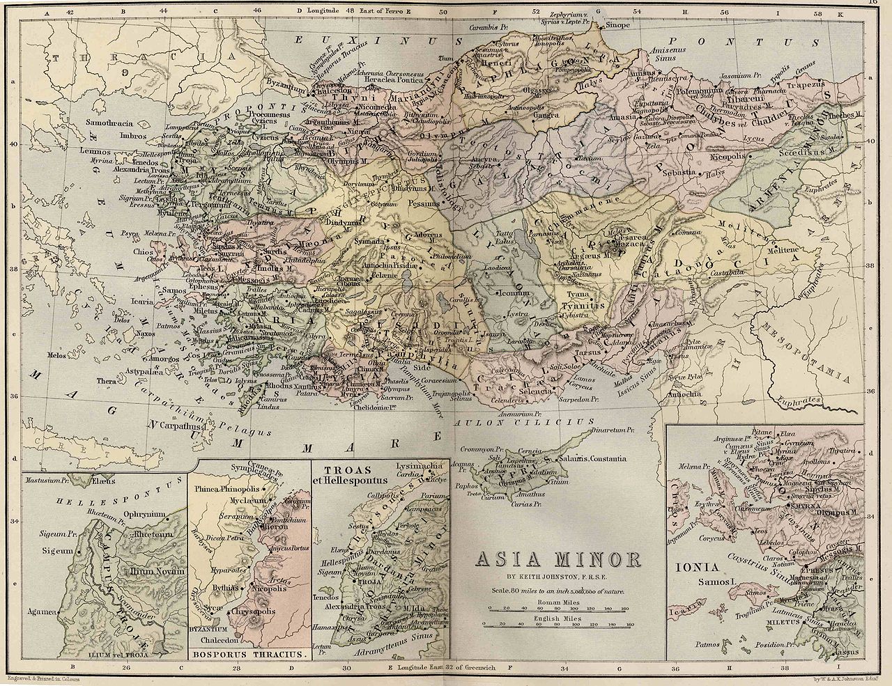
English: Asia Minor. Including Pontus, Cappadocia, Cilicia, Pisidia, Lycia, Caria, Lydia, Mysia, Bithynia, Paphlagonia, Phrygia, and Crete.
"These color maps are 11" x 13.5" when printed at 300dpi. They were copied from an original 1886 Ginn & Company Classical Atlas designed by mapmaker Keith Johnston. These maps are completely Public Domain and can be used absolutely without restriction or even sold commercially without my permission. (There is slight distortion caused by the age of the original and merging the scans (two scans per map)" Information from http://www.snible.org/greek/ |
|||||||||||||||||||
| Datum | ||||||||||||||||||||
| Zdroj | Ginn & Company Classical Atlas | |||||||||||||||||||
| Autor |
|
|||||||||||||||||||
| Další verze | Díla odvozená od tohoto souboru: Location of Isauria-Asia Minor Map, Classical Atlas, 1886, Keith Johnston.jpg | |||||||||||||||||||
Licence
|
Toto dílo je volné také v zemích, jejichž právní řád chrání majetková autorská práva po dobu života autora a 100 let po jeho smrti. | |
| Bylo zjištěno, že u tohoto souboru nejsou známa žádná omezení daná autorským právem a právy s ním souvisejícími. | |
Historie souboru
Kliknutím na datum a čas se zobrazí tehdejší verze souboru.
| Datum a čas | Náhled | Rozměry | Uživatel | Komentář | |
|---|---|---|---|---|---|
| současná | 3. 12. 2009, 23:05 | | 3 669 × 2 824 (917 KB) | Jssfrk | {{Information |Description={{en|1=Asia Minor. Including Pontus, Cappadocia, Cilicia, Pisidia, Lycia, Caria, Lydia, Mysia, Bithynia, Paphlagonia, Phrygia, and Crete. "These color maps are 11" x 13.5" when printed at 300dpi. They were copied from an origin |
Využití souboru
Tento soubor používá následující stránka:
Globální využití souboru
Tento soubor využívají následující wiki:
- Využití na az.wikipedia.org
- Využití na en.wikipedia.org
- Využití na pl.wikipedia.org
- Využití na ru.wikipedia.org
- Využití na tr.wikipedia.org