
Soubor:15th century map of Turkey region.jpg
Velikost tohoto náhledu: 800 × 600 pixelů. Jiná rozlišení: 320 × 240 pixelů | 640 × 480 pixelů | 1 024 × 768 pixelů | 1 280 × 960 pixelů | 2 048 × 1 536 pixelů.
Původní soubor (2 048 × 1 536 pixelů, velikost souboru: 884 KB, MIME typ: image/jpeg)
| Tento soubor pochází z Wikimedia Commons. Níže jsou zobrazeny informace, které obsahuje jeho tamější stránka s popisem souboru. |
| Popis |
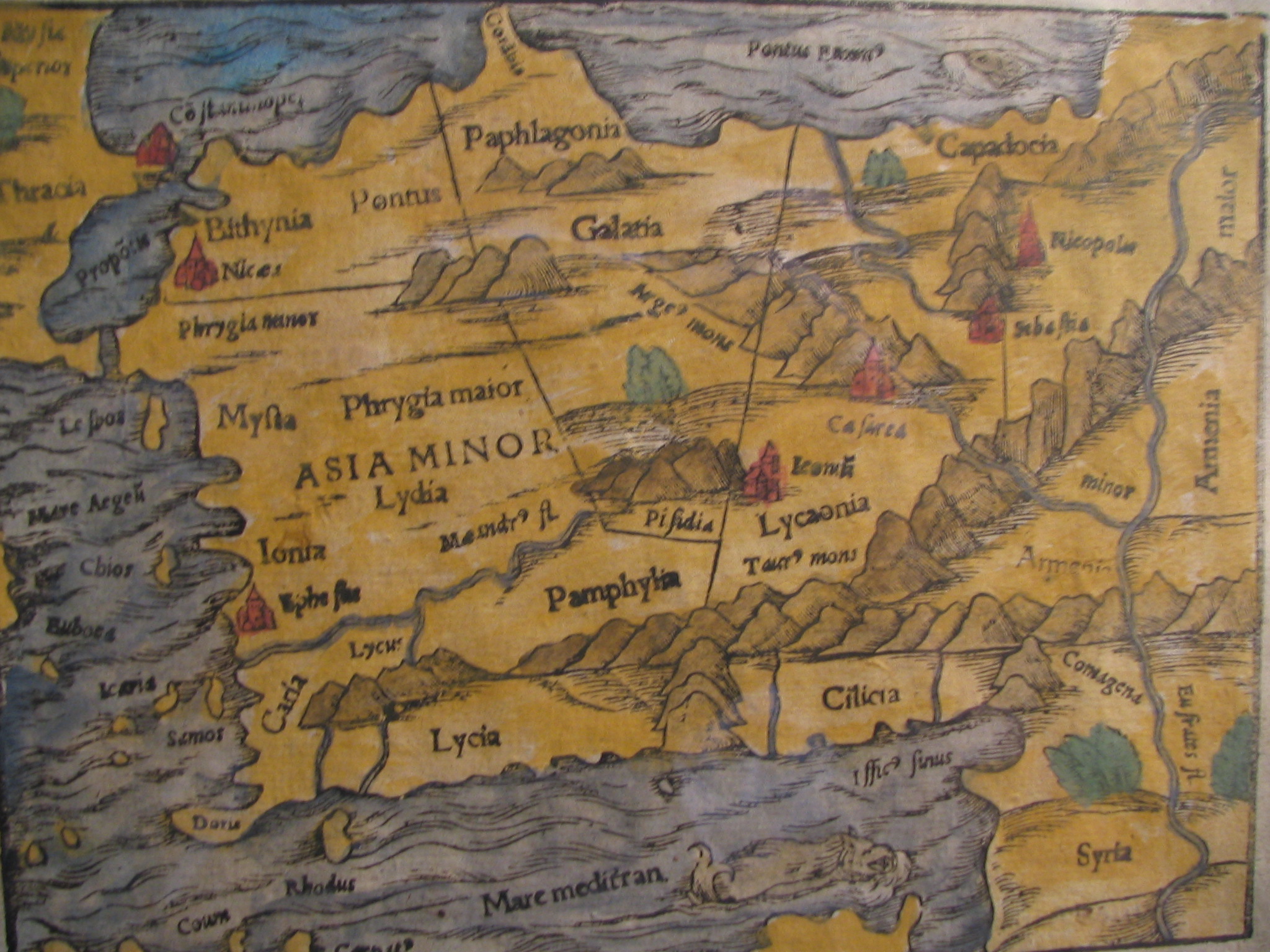
English: Picture of a map of the region of what is now Turkey from the 15th Century. I own this map, having purchased it, and have all official documentation regarding its authenticity. |
||||
| Datum | 15. století, Digitized on: 10. prosince 2006, 19:42:23 | ||||
| Zdroj |
|
||||
| Autor | Neznámý, Photographer: Electionworld | ||||
| Svolení (Užití tohoto souboru) |
Tento soubor podléhá licenci Creative Commons Uveďte autora-Zachovejte licenci 2.5 Generic
|
||||

Historie souboru
Kliknutím na datum a čas se zobrazí tehdejší verze souboru.
| Datum a čas | Náhled | Rozměry | Uživatel | Komentář | |
|---|---|---|---|---|---|
| současná | 21. 2. 2018, 16:04 | | 2 048 × 1 536 (884 KB) | Ket | Reverted to version as of 09:40, 17 December 2006 (UTC) |
| 21. 2. 2018, 16:03 |  | 2 048 × 1 536 (921 KB) | Ket | better contrast | |
| 17. 12. 2006, 11:40 |  | 2 048 × 1 536 (884 KB) | Electionworld | {{ew|en|Rarelibra}} == Summary == Picture of a map of the region of what is now Turkey from the 15th Century. I own this map, having purchased it, and have all official documentation regarding its authenticity. == Licensing == {{cc-by-sa-2.5}} |
Využití souboru
Tento soubor používá následující stránka:
Globální využití souboru
Tento soubor využívají následující wiki:
- Využití na ar.wikipedia.org
- Využití na ast.wikipedia.org
- Využití na bg.wikipedia.org
- Využití na ca.wikipedia.org
- Využití na da.wikipedia.org
- Využití na de.wikipedia.org
- Využití na el.wikipedia.org
- Využití na en.wikipedia.org
- Využití na eo.wikipedia.org
- Využití na es.wikipedia.org
- Využití na eu.wikipedia.org
- Využití na fr.wikipedia.org
- Využití na gl.wikipedia.org
- Využití na hr.wikipedia.org
Zobrazit další globální využití tohoto souboru.