
Soubor:Austrian Empire (1815).svg

Velikost tohoto PNG náhledu tohoto SVG souboru: 450 × 456 pixelů. Jiná rozlišení: 237 × 240 pixelů | 474 × 480 pixelů | 758 × 768 pixelů | 1 011 × 1 024 pixelů | 2 021 × 2 048 pixelů.
Původní soubor (soubor SVG, nominální rozměr: 450 × 456 pixelů, velikost souboru: 691 KB)
| Tento soubor pochází z Wikimedia Commons. Níže jsou zobrazeny informace, které obsahuje jeho tamější stránka s popisem souboru. |
Popis


.svg)
.svg)
.svg)
.svg)
.svg)


.svg)
.svg)
.svg)


.png)
.png)


.svg)


.svg)

.svg)


.svg)
.svg)
.svg)
.svg)


.svg)
.png)


.svg)


.svg)
.svg)


.svg)


.svg)


.svg)
.svg)
.svg)
.svg)
.svg)
.svg)
.svg)
.svg)
_cropped.svg)
.svg)
.svg)
.svg)
.svg)
.svg)
.svg)
.svg)
.svg)
.svg)
.svg)
.svg)
.svg)
.svg)
.svg)
.svg)
.svg)
.svg)
.svg)
.svg)
.svg)
.svg)
.svg)
.svg)
.svg)
.svg)
.svg)
.svg)
.svg)
.svg)
.svg)
.svg)
.svg)
.svg)
.svg)
.svg)
.svg)
.svg)
.svg)
.svg)
.svg)
.svg)
.svg)
.svg)
.svg)
.svg)
Historie souboru
Kliknutím na datum a čas se zobrazí tehdejší verze souboru.
| Datum a čas | Náhled | Rozměry | Uživatel | Komentář | |
|---|---|---|---|---|---|
| současná | 16. 4. 2019, 11:58 | | 450 × 456 (691 KB) | TRAJAN 117 | +++ |
| 12. 8. 2013, 23:20 |  | 450 × 456 (654 KB) | TRAJAN 117 | Update | |
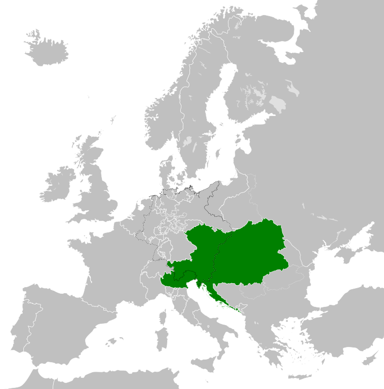
| 12. 8. 2013, 07:47 |  | 450 × 456 (1 MB) | TRAJAN 117 | {{Information |Description ={{en|1=The Austrian Empire in 1815.}} |Source ={{own}} {{AttribSVG|Blank map of Europe 1815.svg|Alphathon}} |Author =TRAJAN 117 {{created with Inkscape}} |Date =2013-08-12 |Pe... |
Využití souboru
Tento soubor používá následující stránka:
Globální využití souboru
Tento soubor využívají následující wiki:
- Využití na af.wikipedia.org
- Využití na ast.wikipedia.org
- Využití na azb.wikipedia.org
- Využití na ba.wikipedia.org
- Využití na bg.wikipedia.org
- Využití na br.wikipedia.org
- Využití na ce.wikipedia.org
- Využití na cy.wikipedia.org
- Využití na de.wikipedia.org
- Využití na el.wikipedia.org
- Využití na en.wikipedia.org
- Využití na es.wikipedia.org
- Využití na fi.wikipedia.org
- Využití na frr.wikipedia.org
- Využití na fr.wikipedia.org
- Využití na ga.wikipedia.org
- Využití na gd.wikipedia.org
- Využití na gl.wikipedia.org
- Využití na he.wikipedia.org
- Využití na hi.wikipedia.org
- Využití na hr.wikipedia.org
- Využití na hy.wikipedia.org
- Využití na id.wikipedia.org
- Využití na id.wikibooks.org
- Využití na incubator.wikimedia.org
- Využití na is.wikipedia.org
- Využití na it.wikipedia.org
- Využití na jam.wikipedia.org
- Využití na ja.wikipedia.org
- Využití na ka.wikipedia.org
- Využití na km.wikipedia.org
- Využití na ko.wikipedia.org
- Využití na ky.wikipedia.org
- Využití na lmo.wikipedia.org
- Využití na lt.wikipedia.org
- Využití na lv.wikipedia.org
- Využití na mk.wikipedia.org
- Využití na mn.wikipedia.org
- Využití na nap.wikipedia.org
- Využití na nl.wikipedia.org
- Využití na pa.wikipedia.org
Zobrazit další globální využití tohoto souboru.
.svg)
.svg)