
Soubor:TXMap-doton-Laredo.PNG
Větší rozlišení není k dispozici
TXMap-doton-Laredo.PNG (300 × 284 pixelů, velikost souboru: 16 KB, MIME typ: image/png)
| Tento soubor pochází z Wikimedia Commons. Níže jsou zobrazeny informace, které obsahuje jeho tamější stránka s popisem souboru. |
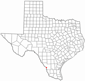
Locator maps U.S. cities derived from PD state maps by different users from en.wikipedia.
the filename has sometimes been adapted to the general syntax

|
Tento dokument smí být kopírován, šířen nebo upravován podle podmínek Svobodné licence GNU pro dokumenty verze 1.2 nebo libovolné vyšší verze publikované nadací Free Software Foundation. Dokument nemá neměnné části ani texty na předním či zadním přebalu. Kopie textu licence je k dispozici v oddíle nazvaném GNU Free Documentation License. |
| Tento soubor podléhá licenci Creative Commons Uveďte autora-Zachovejte licenci 3.0 Unported | ||
| ||
| Tato licenční šablona byla k tomuto souboru přidána v rámci změny licencování. |
Historie souboru
Kliknutím na datum a čas se zobrazí tehdejší verze souboru.
| Datum a čas | Náhled | Rozměry | Uživatel | Komentář | |
|---|---|---|---|---|---|
| současná | 29. 7. 2007, 13:29 | | 300 × 284 (16 KB) | Ö | Reverted to earlier revision |
| 29. 7. 2007, 00:08 |  | 630 × 594 (92 KB) | AMAPO | {{Information |Description=Texas County Map showing Laredo, Texas Location |Source=Modified from http://es.wikipedia.org/wiki/Imagen:Texas_map_-_Dallas_County.svg |Date=July 2007 |Author=drumguy8800 / AMAPO |Permission=GNU Free |other_versions=http://es.w | |
| 10. 2. 2006, 23:54 |  | 300 × 284 (16 KB) | Michiel1972 | Locator maps U.S. cities derived from PD state maps by different users from en.wikipedia. <small>the filename has sometimes been adapted to the general syntax</small> {{GFDL}} category:Location maps of U.S. cities |
Využití souboru
Tento soubor nepoužívá žádná stránka.
Globální využití souboru
Tento soubor využívají následující wiki:
- Využití na da.wikipedia.org
- Využití na fa.wikipedia.org
- Využití na id.wikipedia.org
- Využití na no.wikipedia.org
- Využití na sv.wikipedia.org