
Soubor:Seine-Maritime department relief location map.jpg

Velikost tohoto náhledu: 800 × 584 pixelů. Jiná rozlišení: 320 × 234 pixelů | 640 × 467 pixelů | 1 024 × 748 pixelů | 1 331 × 972 pixelů.
Původní soubor (1 331 × 972 pixelů, velikost souboru: 211 KB, MIME typ: image/jpeg)
| Tento soubor pochází z Wikimedia Commons. Níže jsou zobrazeny informace, které obsahuje jeho tamější stránka s popisem souboru. |
Popis
| Pozice fotografa | | Tento snímek a mnohé další na: OpenStreetMap |
|---|
| Popis |
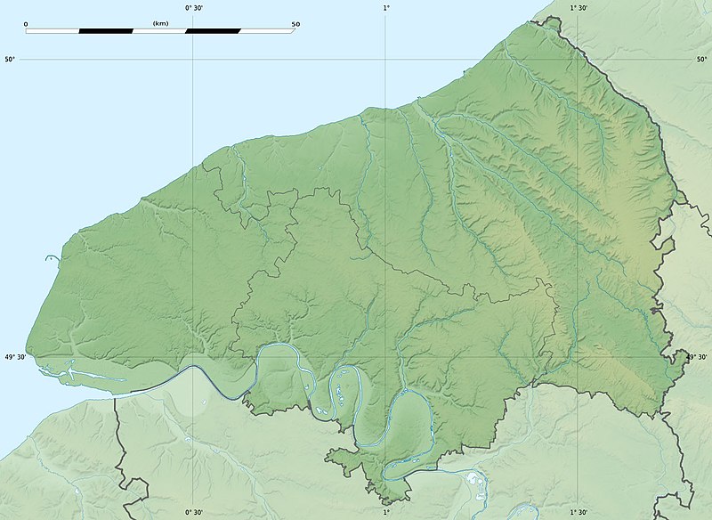
Français : Carte physique vierge du département de la Seine-Maritime, France, destinée à la géolocalisation. Scales:
Equirectangular projection, WGS84 datum
Geographic limits of the map:
|
||
| Datum | |||
| Zdroj |
Vlastní dílo
|
||
| Autor | Eric Gaba (Sting - fr:Sting) | ||
| Svolení (Užití tohoto souboru) |
|
||
| Další verze |
|

Licence
Eric Gaba, Wikimedia Commons user Sting, držitel autorských práv k tomuto dílu, ho tímto zveřejňuje za podmínek následující licence:
Tento soubor podléhá licenci Creative Commons Uveďte autora-Zachovejte licenci 3.0 Unported
Uveďte autora: Eric Gaba, Wikimedia Commons user Sting
- Dílo smíte:
- šířit – kopírovat, distribuovat a sdělovat veřejnosti
- upravovat – pozměňovat, doplňovat, využívat celé nebo částečně v jiných dílech
- Za těchto podmínek:
- uveďte autora – Máte povinnost uvést autorství, poskytnout odkaz na licenci a uvést, pokud jste provedli změny. Toho můžete docílit jakýmkoli rozumným způsobem, avšak ne způsobem naznačujícím, že by poskytovatel licence schvaloval nebo podporoval vás nebo vaše užití díla.
- zachovejte licenci – Pokud tento materiál jakkoliv upravíte, přepracujete nebo použijete ve svém díle, musíte své příspěvky šířit pod stejnou nebo slučitelnou licencí jako originál.
Historie souboru
Kliknutím na datum a čas se zobrazí tehdejší verze souboru.
| Datum a čas | Náhled | Rozměry | Uživatel | Komentář | |
|---|---|---|---|---|---|
| současná | 18. 7. 2010, 23:18 | | 1 331 × 972 (211 KB) | Sting | Color profile |
| 30. 6. 2010, 19:31 |  | 1 331 × 972 (218 KB) | Sting | == {{int:filedesc}} == {{Location|49|39|45|N|00|55|30|E|scale:400000}} <br/> {{Information |Description={{en|Blank physical map of the department of Seine-Maritime, France, for geo-locati |
Využití souboru
Tento soubor používá následující stránka:
Globální využití souboru
Tento soubor využívají následující wiki:
- Využití na als.wikipedia.org
- Využití na de.wikipedia.org
- Využití na de.wikivoyage.org
- Využití na en.wikipedia.org
- Využití na eo.wikipedia.org
- Havro
- Rueno
- Fécamp
- Dieppe
- Le Grand-Quevilly
- Forges-les-Eaux
- Saint-Saëns
- Clères
- Ŝablono:Situo sur mapo Francio Seine-Maritime
- Tram-metroo de Rouen
- Lillebonne
- Saint-Étienne-du-Rouvray
- Le Tréport
- Yvetot
- Rolleville
- Montivilliers
- Saint-Aubin-lès-Elbeuf
- Elbeuf
- Oissel
- Serqueux (Seine-Maritime)
- Bréauté
- Beuzeville-la-Grenier
- Sotteville-lès-Rouen
- Varengeville-sur-Mer
- Sainte-Marguerite-sur-Mer
- Aumale (Seine-Maritime)
- Eu (Seine-Maritime)
- Amfreville-la-Mi-Voie
- Arques-la-Bataille
- Aubermesnil-Beaumais
- Belbeuf
- Bihorel
- Bois-Guillaume
- Bonsecours (Seine-Maritime)
- La Bouille
- Ancourt
- Canteleu
Zobrazit další globální využití tohoto souboru.