
Soubor:River Forth course 3.png

Velikost tohoto náhledu: 800 × 322 pixelů. Jiná rozlišení: 320 × 129 pixelů | 640 × 258 pixelů | 1 024 × 413 pixelů | 2 000 × 806 pixelů.
Původní soubor (2 000 × 806 pixelů, velikost souboru: 981 KB, MIME typ: image/png)
| Tento soubor pochází z Wikimedia Commons. Níže jsou zobrazeny informace, které obsahuje jeho tamější stránka s popisem souboru. |
Popis
| Popis |
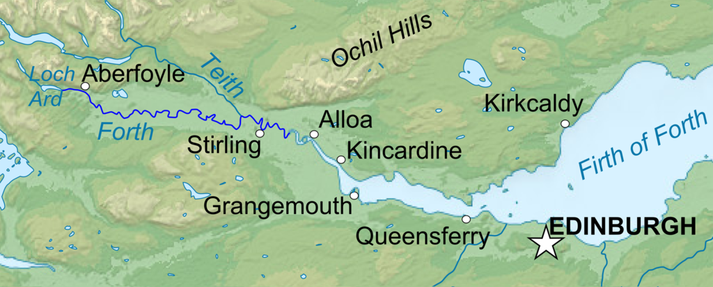
English: Topographic map in English of Scotland This is a lighter raster JPG format version of Image:Scotland_topographic_map-en.svg which should be used in the article pages, the vector graphics version purpose being for modification and / or translation. Français : Carte topographique en anglais de l'Écosse. *UTM projection ; WGS84 datum ; shaded relief (composite image of N-W, W and N lightning positions) ;Ceci est une version bitmap au format JPG et de poids de fichier plus léger de Image:Scotland_topographic_map-fr.svg qui devrait être utilisée dans les pages d'articles, la version vectorisée SVG étant destinée à faciliter les modifications et / ou traductions. *Scales: **Topography and shore/lakes limits: 1:872,000 (accuracy: 218 m) until 60.38° and 1:3,800,000 (accuracy: 950 m) North of 60.38° ; ** Bathymetry: 1:7,588,000 (accuracy: 1,897 m) |
| Datum | (UTC) |
| Zdroj |
Tento soubor byl odvozen z: Scotland topographic map-en.jpg:  |
| Autor |
|
| Toto je upravený obrázek, což znamená, že byl oproti původní verzi digitálně změněn. Úpravy: Isolated the river forth area. Původní verzi je možné zhlédnout zde: Scotland topographic map-en.jpg. Úpravy provedl VanguardScot.
|
Licence
Já, držitel autorských práv k tomuto dílu, ho tímto zveřejňuji za podmínek následujících licencí:
Tento soubor podléhá licenci Creative Commons Uveďte autora-Zachovejte licenci 3.0 Unported, 2.5 Generic, 2.0 Generic a 1.0 Generic.
- Dílo smíte:
- šířit – kopírovat, distribuovat a sdělovat veřejnosti
- upravovat – pozměňovat, doplňovat, využívat celé nebo částečně v jiných dílech
- Za těchto podmínek:
- uveďte autora – Máte povinnost uvést autorství, poskytnout odkaz na licenci a uvést, pokud jste provedli změny. Toho můžete docílit jakýmkoli rozumným způsobem, avšak ne způsobem naznačujícím, že by poskytovatel licence schvaloval nebo podporoval vás nebo vaše užití díla.
- zachovejte licenci – Pokud tento materiál jakkoliv upravíte, přepracujete nebo použijete ve svém díle, musíte své příspěvky šířit pod stejnou nebo slučitelnou licencí jako originál.

|
Tento dokument smí být kopírován, šířen nebo upravován podle podmínek Svobodné licence GNU pro dokumenty verze 1.2 nebo libovolné vyšší verze publikované nadací Free Software Foundation. Dokument nemá neměnné části ani texty na předním či zadním přebalu. Kopie textu licence je k dispozici v oddíle nazvaném GNU Free Documentation License. |
Můžete si zvolit libovolnou z těchto licencí.
Původní historie souboru
This image is a derivative work of the following images:
- File:Scotland_topographic_map-en.jpg licensed with Cc-by-sa-3.0,2.5,2.0,1.0, GFDL
- 2010-07-17T21:41:29Z Sting 2400x3450 (2398211 Bytes) Color profile
- 2008-09-24T23:35:01Z Sting 2400x3450 (2082807 Bytes) Completely new background : raster topography and using ETOPO1 data for bathymetry ; new standard colors
- 2007-12-14T01:02:41Z Sting 2400x3450 (2224139 Bytes) Additional name
- 2007-12-12T20:55:32Z Sting 2400x3450 (2220337 Bytes) Correction in key
- 2007-12-12T16:18:25Z Sting 2400x3450 (2218854 Bytes) {{Location|57|00|00|N|04|00|00|W|scale:4000000}} {{Information |Description=Topographic map in English of [[:en:Scotland|Scotland]]This is a lighter raster JPG format version of [[:Image:Scotland_topographic_map-en.svg]] whi
Uploaded with derivativeFX
Historie souboru
Kliknutím na datum a čas se zobrazí tehdejší verze souboru.
| Datum a čas | Náhled | Rozměry | Uživatel | Komentář | |
|---|---|---|---|---|---|
| současná | 23. 1. 2013, 00:04 | 2 000 × 806 (981 KB) | VanguardScot | Added loch ard, highlighted the actual river forth | |
| 22. 1. 2013, 23:57 | 2 988 × 1 204 (991 KB) | VanguardScot | added grangemouth | ||
| 18. 1. 2013, 00:27 | 715 × 263 (314 KB) | VanguardScot | == {{int:filedesc}} == {{Information |Description={{en|Topographic map in English of Scotland<br/>This is a lighter raster JPG format version of Image:Scotland_topographic_map-en.svg which should be used in the article pages, the ... |
Využití souboru
Tento soubor používá následující stránka:
Globální využití souboru
Tento soubor využívají následující wiki:
- Využití na ca.wikipedia.org
- Využití na en.wikipedia.org
- Využití na et.wikipedia.org
- Využití na fa.wikipedia.org
- Využití na fi.wikipedia.org
- Využití na fr.wikipedia.org
- Využití na he.wikipedia.org
- Využití na is.wikipedia.org
- Využití na it.wikipedia.org
- Využití na ja.wikipedia.org
- Využití na no.wikipedia.org
- Využití na sh.wikipedia.org
- Využití na sr.wikipedia.org
- Využití na uk.wikipedia.org