
Soubor:Riparian strip.jpg
Větší rozlišení není k dispozici
Riparian_strip.jpg (655 × 441 pixelů, velikost souboru: 59 KB, MIME typ: image/jpeg)
| Tento soubor pochází z Wikimedia Commons. Níže jsou zobrazeny informace, které obsahuje jeho tamější stránka s popisem souboru. |
| Pozice objektu | | Tento snímek a mnohé další na: OpenStreetMap |
|---|
| Popis |
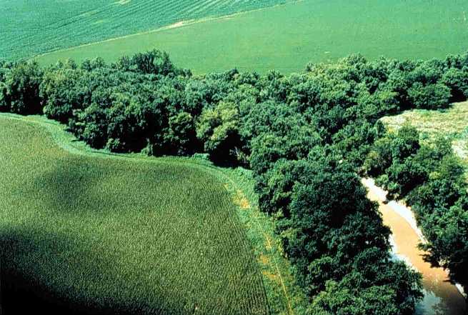
English: Riparian strip on a Lake Erie tributary. Location is the northeastern corner of Van Buren Township, Putnam County, Ohio, United States, east of the village of Belmore; this is the confluence of Yellow Creek and a tiny unnamed run. |
|||
| Datum | neznámé datum | |||
| Zdroj | [1] (context) | |||
| Autor | U.S. Department of Agriculture | |||
| Svolení (Užití tohoto souboru) |
|

![[1]](https://web.archive.org/web/20051220220554/http://www.oh.nrcs.usda.gov/programs/Lake_Erie_Buffer/images/riparian_putnam_co.jpg)
Historie souboru
Kliknutím na datum a čas se zobrazí tehdejší verze souboru.
| Datum a čas | Náhled | Rozměry | Uživatel | Komentář | |
|---|---|---|---|---|---|
| současná | 29. 7. 2005, 00:29 | | 655 × 441 (59 KB) | Duk | Riparian strip, Putnam County, Ohio, Lake Erie tributary. {{PD-USGov-USDA}} source: http://www.oh.nrcs.usda.gov/programs/Lake_Erie_Buffer/images/riparian_putnam_co.jpg en:Riparian strips |
Využití souboru
Tento soubor používá následující stránka:
Globální využití souboru
Tento soubor využívají následující wiki:
- Využití na an.wikipedia.org
- Využití na ar.wikipedia.org
- Využití na be.wikipedia.org
- Využití na bn.wikipedia.org
- Využití na bs.wikipedia.org
- Využití na ca.wikipedia.org
- Využití na cy.wikipedia.org
- Využití na en.wikipedia.org
- Využití na en.wiktionary.org
- Využití na eo.wikipedia.org
- Využití na es.wikipedia.org
- Využití na eu.wikipedia.org
- Využití na fa.wikipedia.org
- Využití na fi.wikipedia.org
- Využití na fr.wikipedia.org
- Využití na gl.wikipedia.org
- Využití na id.wikipedia.org
- Využití na it.wikipedia.org
- Využití na ja.wikipedia.org
- Využití na ka.wikipedia.org
- Využití na ko.wikipedia.org
- Využití na nl.wikipedia.org
- Využití na oc.wikipedia.org
- Využití na pt.wikipedia.org
- Využití na ru.wikipedia.org
- Využití na sh.wikipedia.org
- Využití na sv.wikipedia.org
- Využití na tt.wikipedia.org
- Využití na uk.wikipedia.org
- Využití na www.wikidata.org
Zobrazit další globální využití tohoto souboru.