
Soubor:Level III ecoregions, United States.png

Velikost tohoto náhledu: 800 × 506 pixelů. Jiná rozlišení: 320 × 202 pixelů | 640 × 405 pixelů | 1 024 × 648 pixelů | 1 600 × 1 012 pixelů.
Původní soubor (1 600 × 1 012 pixelů, velikost souboru: 791 KB, MIME typ: image/png)
| Tento soubor pochází z Wikimedia Commons. Níže jsou zobrazeny informace, které obsahuje jeho tamější stránka s popisem souboru. |
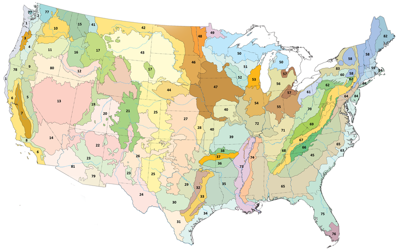
Popis
| Popis |
English: Level III ecoregions in the United States, as defined by the U.S. Environmental Protection Agency |
| Datum | |
| Zdroj | Modified from US EPA map |
| Autor | U.S. Environmental Protection Agency |
| Další verze |
Díla odvozená od tohoto souboru: |
| Key |
|
Licence
This image (or other media) is a work of an Environmental Protection Agency employee, taken or made as part of that person's official duties. As works of the U.S. federal government, all EPA images are in the public domain.
|
||
Historie souboru
Kliknutím na datum a čas se zobrazí tehdejší verze souboru.
| Datum a čas | Náhled | Rozměry | Uživatel | Komentář | |
|---|---|---|---|---|---|
| současná | 19. 6. 2008, 09:58 | | 1 600 × 1 012 (791 KB) | Northwest-historian | {{Information |Description={{en|1=Level III ecoregions in the Pacific Northwest, as defined by the U.S. Environmental Protections Agency }} |Source=Modified from US EPA map at [http://www.epa.gov/wed/pages/ecoregions/level_iii.htm] |Author=U.S. Environmen |
Využití souboru
Tento soubor používá následující stránka:
Globální využití souboru
Tento soubor využívají následující wiki:
- Využití na bg.wikipedia.org
- Среден Царевичен пояс
- Южна крайбрежна равнина
- Югозападни Апалачи
- Средни Апалачи
- Средни Велики равнини
- Флинт Хилс
- Северен Пидмънт
- Източноголемоезерна низина
- Югоизточни равнини
- Атлантически борови крайбрежни низини
- Западно Алигейнско плато
- Акадски равнини и хълмове
- Вътрешни речни долини и хълмове
- Вътрешно плато
- Североизточна крайбрежна зона
- Льосови равнини на Мисисипската долина
- Пайни Удс
- Северни централни широколистни гори
- Využití na de.wikipedia.org
- Využití na en.wikipedia.org
- Využití na eo.wikipedia.org
- Využití na fr.wikipedia.org
- Využití na ru.wikipedia.org
- Využití na sv.wikipedia.org
- Využití na uk.wikipedia.org
- Využití na www.wikidata.org