
Soubor:Island of Ireland location map Londonderry.svg

Velikost tohoto PNG náhledu tohoto SVG souboru: 796 × 599 pixelů. Jiná rozlišení: 319 × 240 pixelů | 638 × 480 pixelů | 1 020 × 768 pixelů | 1 280 × 964 pixelů | 2 560 × 1 928 pixelů | 931 × 701 pixelů.
Původní soubor (soubor SVG, nominální rozměr: 931 × 701 pixelů, velikost souboru: 826 KB)
| Tento soubor pochází z Wikimedia Commons. Níže jsou zobrazeny informace, které obsahuje jeho tamější stránka s popisem souboru. |
| Popis |
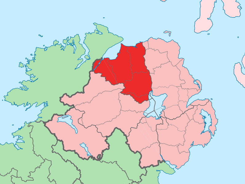
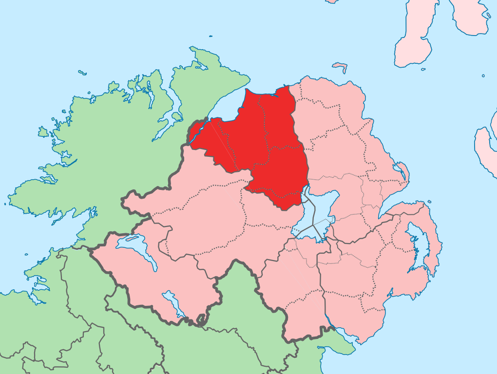
English: The island of Ireland, showing international border between Ireland and Northern Ireland, traditional provinces, traditional counties, and local authority areas in Ireland and Northern Ireland. |
| Datum | (UTC) |
| Zdroj | |
| Autor |
|
| Toto je upravený obrázek, což znamená, že byl oproti původní verzi digitálně změněn. Úpravy: Added colours to distinguish county in focus. Původní verzi je možné zhlédnout zde: Island of Ireland location map.svg. Úpravy provedl Mabuska.
|
Já, držitel autorských práv k tomuto dílu, ho tímto zveřejňuji za podmínek následující licence:
Tento soubor podléhá licenci Creative Commons Uveďte autora-Zachovejte licenci 3.0 Unported
- Dílo smíte:
- šířit – kopírovat, distribuovat a sdělovat veřejnosti
- upravovat – pozměňovat, doplňovat, využívat celé nebo částečně v jiných dílech
- Za těchto podmínek:
- uveďte autora – Máte povinnost uvést autorství, poskytnout odkaz na licenci a uvést, pokud jste provedli změny. Toho můžete docílit jakýmkoli rozumným způsobem, avšak ne způsobem naznačujícím, že by poskytovatel licence schvaloval nebo podporoval vás nebo vaše užití díla.
- zachovejte licenci – Pokud tento materiál jakkoliv upravíte, přepracujete nebo použijete ve svém díle, musíte své příspěvky šířit pod stejnou nebo slučitelnou licencí jako originál.
Původní historie souboru
This image is a derivative work of the following images:
- File:Island_of_Ireland_location_map.svg licensed with Cc-by-sa-3.0
- 2010-03-06T20:43:33Z Rannpháirtí anaithnid 1450x1807 (679207 Bytes) Fix incorrectly coloured isands.
- 2010-03-03T22:19:29Z Rannpháirtí anaithnid 1450x1807 (679744 Bytes) {{Information |Description={{de|Positionskarte von [[:de:Irland|Irland]]}} Quadratische Plattkarte, N-S-Streckung 170 %. Geographische Begrenzung der Karte: * N: 55.6° N * S: 51.2° N * W: 11.0° W * O: 5.0° W {{en|Location
Uploaded with derivativeFX
Historie souboru
Kliknutím na datum a čas se zobrazí tehdejší verze souboru.
| Datum a čas | Náhled | Rozměry | Uživatel | Komentář | |
|---|---|---|---|---|---|
| současná | 19. 7. 2010, 15:14 | | 931 × 701 (826 KB) | Mabuska | another attempt |
| 19. 7. 2010, 15:07 |  | 931 × 701 (826 KB) | Mabuska | attempt to fix boundary issues | |
| 19. 7. 2010, 13:36 |  | 934 × 717 (828 KB) | Mabuska | {{Information |Description={{en|The island of Ireland, showing international border between Northern Ireland and Republic of Ireland, traditional provinces, traditional counties, and local authority areas in the Republic of Ireland and Northern Ireland.}} |
Využití souboru
Tento soubor používá následující stránka:
Globální využití souboru
Tento soubor využívají následující wiki:
- Využití na an.wikipedia.org
- Využití na bg.wikipedia.org
- Využití na de.wikipedia.org
- Využití na en.wikipedia.org
- Derry
- County Londonderry
- Limavady
- Dungiven
- Sperrins
- Coleraine
- Portstewart
- Moneymore
- Draperstown
- List of Ireland-related topics
- Maghera
- Corick
- Magilligan
- Lough Foyle
- List of places in Northern Ireland
- Magherafelt
- Bogside
- Free Derry Corner
- List of places in County Londonderry
- Ballynahone Bog
- Binevenagh
- Castledawson
- Glenshane Pass
- Drumsurn
- Ballykelly, County Londonderry
- Swatragh
- Castlerock
- Newbuildings
- Ballynagalliagh
- Shantallow
- Eglinton, County Londonderry
- Claudy
- Articlave
- Bellaghy
- Clady, County Londonderry
- Culmore
- Burnfoot, County Londonderry
- Downhill, County Londonderry
- Feeny
- Garvagh
- Greysteel
- Kilrea
- Lettershandoney
- Macosquin
- Strathfoyle
- Tobermore
- Ballyrashane
Zobrazit další globální využití tohoto souboru.