
Soubor:Geological map germany 1869.jpg

Původní soubor (1 823 × 2 132 pixelů, velikost souboru: 921 KB, MIME typ: image/jpeg)
| Tento soubor pochází z Wikimedia Commons. Níže jsou zobrazeny informace, které obsahuje jeho tamější stránka s popisem souboru. |
| Popis |
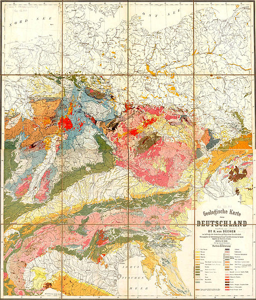
Deutsch: Geologische Karte von Deutschland
English: Geological map of Germany
Español: Mapa geológico de Alemania |
| Datum | |
| Zdroj | repro |
| Autor | Deutsche Geologische Gesellschaft |
| Svolení (Užití tohoto souboru) |
copyright expired |
| Další verze | Image:Geological_map_germany_1869_equirect.png (equirectangular transformed) |
It says:
|
Geologische Karte |
Geological map |
|
im Auftrage der deutschen geologischen Gesellschaft. Farben-Erklärung. |
by order of german geological Society. Legend of Colours. |
|
Toto dílo je volné také v zemích, jejichž právní řád chrání majetková autorská práva po dobu života autora a 70 let po jeho smrti.
| |
| Bylo zjištěno, že u tohoto souboru nejsou známa žádná omezení daná autorským právem a právy s ním souvisejícími. | |
Historie souboru
Kliknutím na datum a čas se zobrazí tehdejší verze souboru.
| Datum a čas | Náhled | Rozměry | Uživatel | Komentář | |
|---|---|---|---|---|---|
| současná | 8. 7. 2006, 08:17 | | 1 823 × 2 132 (921 KB) | Hgrobe | {{Information| |Description=Geological map of Germany, issued by the Deutsche Geologische Gesellschaft in 1869 |Source=own work |Date=2006-07-07 |Author=Hannes Grobe |Permission=Own work, share alike, attribution required (Creative Commons CC-BY-SA-2.5) | |
Využití souboru
Tento soubor používá následující stránka:
Globální využití souboru
Tento soubor využívají následující wiki:
- Využití na als.wikipedia.org
- Využití na de.wikipedia.org
- Využití na incubator.wikimedia.org