
Soubor:Geographic Map of Mexico.jpg
Velikost tohoto náhledu: 800 × 564 pixelů. Jiná rozlišení: 320 × 226 pixelů | 640 × 451 pixelů | 1 024 × 722 pixelů.
Původní soubor (1 024 × 722 pixelů, velikost souboru: 455 KB, MIME typ: image/jpeg)
| Tento soubor pochází z Wikimedia Commons. Níže jsou zobrazeny informace, které obsahuje jeho tamější stránka s popisem souboru. |
Popis
| Popis |
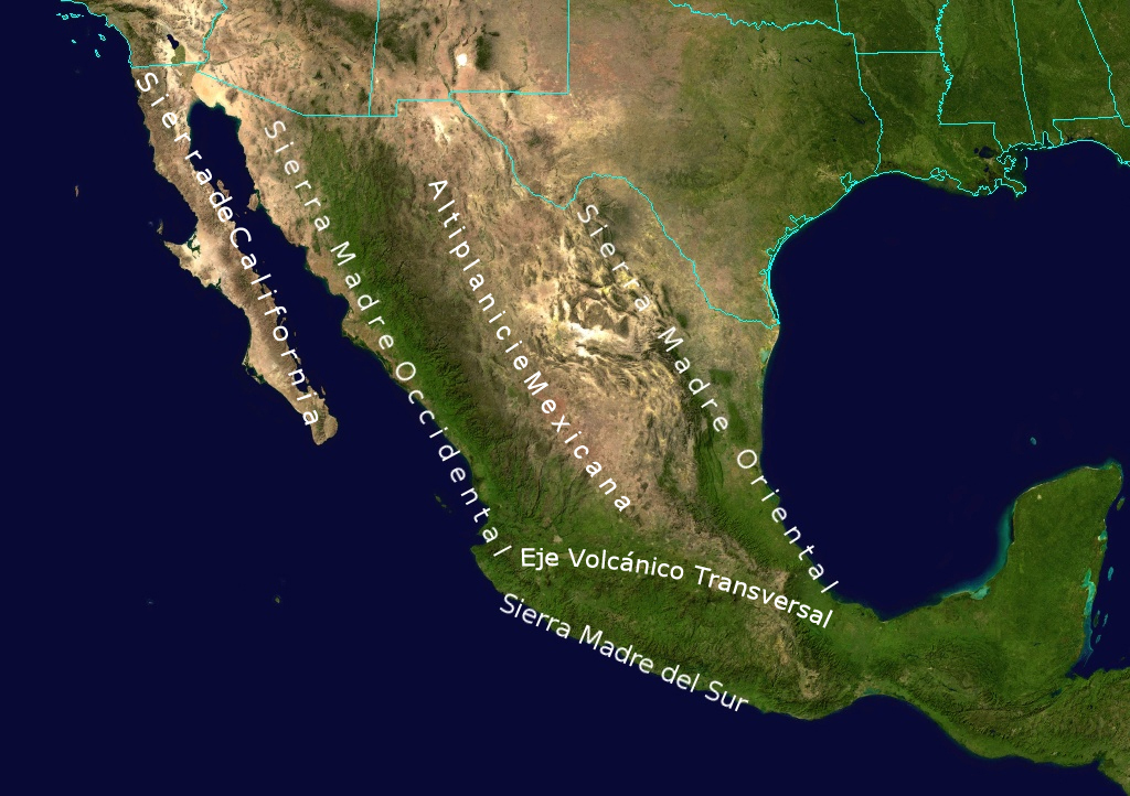
English: Topological Map labeling the most important elevations of the country |
| Datum | |
| Zdroj | NASA |
| Autor | NASA - derivative work by Ricraider |
Licence
| This file is in the public domain in the United States because it was solely created by NASA. NASA copyright policy states that "NASA material is not protected by copyright unless noted". (See Template:PD-USGov, NASA copyright policy page or JPL Image Use Policy.) | ||
 |
Warnings:
|
Původní historie souboru
Původní stránka s popisem souboru byla zde. Všechna následující uživatelská jména odkazují na projekt en.wikipedia.
- 2010-08-24 02:05 Ricraider 1024×722× (465741 bytes) {{Information |Description = Topological Map labeling the most important elevations of the country |Source = NASA |Date = 8-23-10 |Author = ricraider |Permission = |other_versions = }}
Historie souboru
Kliknutím na datum a čas se zobrazí tehdejší verze souboru.
| Datum a čas | Náhled | Rozměry | Uživatel | Komentář | |
|---|---|---|---|---|---|
| současná | 21. 12. 2012, 11:02 | | 1 024 × 722 (455 KB) | Urdangaray | {{Information |Description={{en|Topological Map labeling the most important elevations of the country}} |Source=Transferred from [http://en.wikipedia.org en.wikipedia]<br/> (Original text : ''NASA'') |Date=8-23-10<br/> ({{Original upload date|2010-08-2... |
Využití souboru
Tento soubor používá následující stránka:
Globální využití souboru
Tento soubor využívají následující wiki:
- Využití na bs.wikipedia.org
- Využití na de.wikipedia.org
- Využití na en.wikipedia.org
- Využití na es.wikipedia.org
- Využití na eu.wikipedia.org
- Využití na fa.wikipedia.org
- Využití na is.wikipedia.org
- Využití na ja.wikipedia.org
- Využití na nn.wikipedia.org
- Využití na no.wikipedia.org
- Využití na pl.wikipedia.org
- Využití na simple.wikipedia.org
- Využití na sk.wikipedia.org
- Využití na sv.wikipedia.org
- Využití na tr.wikipedia.org
- Využití na uk.wikipedia.org
- Využití na zh.wikipedia.org