
Soubor:Europa 1400.jpg
Původní soubor (3 054 × 2 436 pixelů, velikost souboru: 2,01 MB, MIME typ: image/jpeg)
| Tento soubor pochází z Wikimedia Commons. Níže jsou zobrazeny informace, které obsahuje jeho tamější stránka s popisem souboru. |
_en.png)
.png)
.jpg)
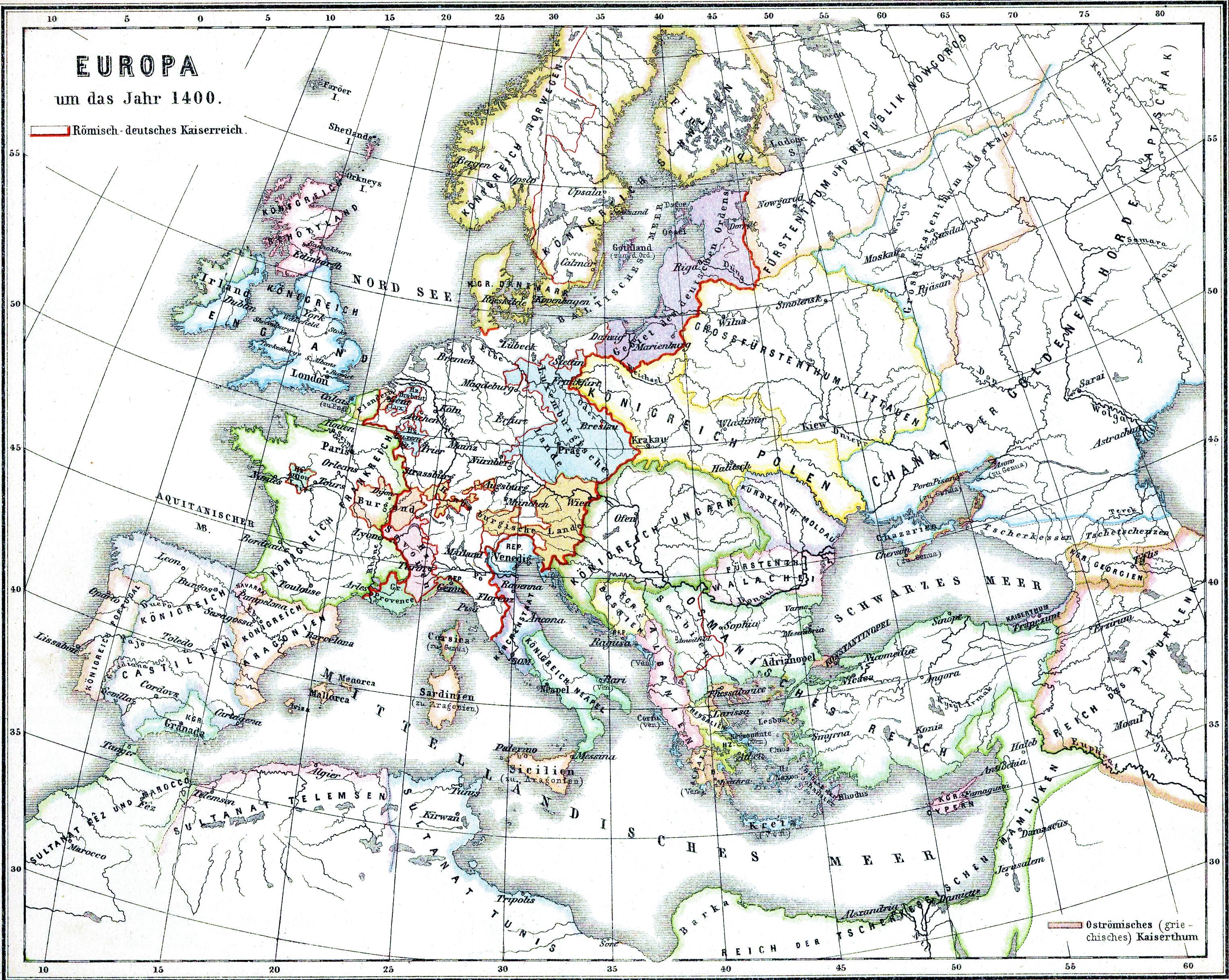
| Popis |
Deutsch: Europa im Jahre 1400 |
| Datum | |
| Zdroj | Historischer Schulatlas. |
| Autor | H.Kiepert |
|
Toto dílo je volné také v zemích, jejichž právní řád chrání majetková autorská práva po dobu života autora a 70 let po jeho smrti.
| |
| Bylo zjištěno, že u tohoto souboru nejsou známa žádná omezení daná autorským právem a právy s ním souvisejícími. | |
Historie souboru
Kliknutím na datum a čas se zobrazí tehdejší verze souboru.
| Datum a čas | Náhled | Rozměry | Uživatel | Komentář | |
|---|---|---|---|---|---|
| současná | 28. 4. 2009, 18:35 | | 3 054 × 2 436 (2,01 MB) | Alex:D | whitened |
| 16. 2. 2009, 20:03 |  | 3 054 × 2 436 (2,99 MB) | Olahus | {{Information |Description={{de|Europa im Jahre 1400}} |Source=Historischer Schulatlas. |Date=1879 |Author=H.Kiepert |Permission= |other_versions= }} {{PD-old}} Category:Maps in German Category:Old maps of Europe [[Category:Maps showing history o |
Využití souboru
Tento soubor používá následující stránka:
Globální využití souboru
Tento soubor využívají následující wiki:
- Využití na ba.wikipedia.org
- Využití na ce.wikipedia.org
- Využití na cv.wikipedia.org
- Využití na en.wikipedia.org
- Využití na frr.wikipedia.org
- Využití na ja.wikipedia.org
- Využití na no.wikipedia.org
- Antikken
- Den industrielle revolusjon
- Renessansen
- Vikingtiden
- Den kalde krigen
- Middelalderen
- Wikipedia:Maler/Historie
- Europas historie
- Senmiddelalderen
- Mal:Europas historie
- Folkevandringstiden
- Høymiddelalderen
- Tidlig middelalder
- Europeisk kolonisering
- Portal:Den kalde krigen
- Tidlig moderne tid
- Europas historie 1789–1914
- Renessanse og reformasjon i Europa
- Bruker:Andreas Kolle/sandkasse
- Motreformasjon og religionskrig (1556–1648)
- Opplyst enevelde i Europa
- Využití na pt.wikipedia.org
- Využití na ro.wikipedia.org
- Využití na ru.wikipedia.org
- Využití na tt.wikipedia.org
- Využití na vi.wikipedia.org