Soubor:Deception pass bridge.jpg

Obsah stránky není podporován v jiných jazycích.
Z Wikipedie, otevřené encyklopedie

Původní soubor(4 564 × 3 169 pixelů, velikost souboru: 1,22 MB, MIME typ: image/jpeg)

This is an image of a place or building that is listed on the National Register of Historic Places in the United States of America. Its reference number is 82004285.

Popis

Popis Deception Pass Bridge, Spanning Deception Pass at State Route 20, Anacortes vicinity, Skagit County, WA. Looking West from water level.
Datum
Zdroj
image extraction process
Tento soubor byl vyříznut ze souboru
: DECEPTION PASS BRIDGE LOOKING WEST FROM WATER LEVEL - Deception Pass Bridge, Spanning Deception Pass at State Route 20, Anacortes, Skagit County, WA HAER WASH,29-ANAC.V,2-8.tif
original file

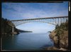
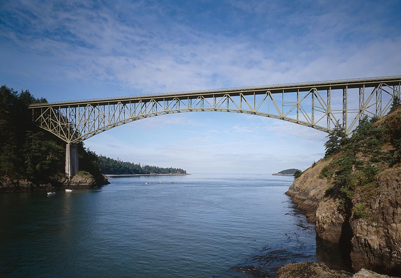
Historic American Engineering Record, Library of Congress HAER WASH,29-ANAC.V,2-8

Tento obrázek je k dispozici v oddělení Prints and Photographs division americké Knihovny Kongresu pod digitálním ID hhh.wa0458.
Toto oznámení nepopisuje autorskoprávní status tohoto souboru. Stále je vyžadován běžný popisek licence. Další informace najdete na Commons:Licencování.

العربية  беларуская (тарашкевіца)  বাংলা  čeština  Deutsch  English  español  فارسی  suomi  français  galego  עברית  magyar  Bahasa Indonesia  italiano  日本語  lietuvių  македонски  മലയാളം  Nederlands  polski  português  português do Brasil  română  русский  sicilianu  slovenčina  slovenščina  Türkçe  українська  简体中文  繁體中文  +/−

Autor
Jet Lowe  (1947–)  wikidata:Q6188857
 
Jet Lowe
Pseudonym
John T. "Jet" Lowe
Popis americký fotograf a fotograf architektury
Datum narození 1947 Edit this at Wikidata
Období tvorby 2013 Edit this at Wikidata
Místo tvorby
one of the photographers employed by the U.S. National Park Service on the Historic American Building Survey and Historic American Engineering Record projects
Soubor autorit
creator QS:P170,Q6188857
Pozice objektu48° 24′ 31″ s. š., 122° 38′ 37″ z. d. Kartographer map based on OpenStreetMap.Tento snímek a mnohé další na: OpenStreetMapinfo

Licence

Public domain This image or media file contains material based on a work of a National Park Service employee, created as part of that person's official duties. As a work of the U.S. federal government, such work is in the public domain in the United States. See the NPS website and NPS copyright policy for more information.

Popisky

Přidejte jednořádkové vysvětlení, co tento soubor představuje

Položky vyobrazené v tomto souboru

zobrazuje

48°24'31.000"N, 122°38'37.000"W

Historie souboru

Kliknutím na datum a čas se zobrazí tehdejší verze souboru.

Datum a časNáhledRozměryUživatelKomentář
současná28. 9. 2009, 23:23Náhled verze z 28. 9. 2009, 23:234 564 × 3 169 (1,22 MB)Martin H.high res
4. 2. 2008, 15:07Náhled verze z 4. 2. 2008, 15:07950 × 651 (104 KB)Matthiasb{{Information |Description={{en|Found on the Library of Congress web site. Not all images displayed in this catalog are in the public domain. The Library offers broad public access to these materials as a contribution to education and scholarship. [http

Tento soubor používá následující stránka:

Globální využití souboru

Metadata