
Soubor:Aufnahmeblatt 4656-2 Stockerau, Göllersdorf.jpg

Původní soubor (10 110 × 7 286 pixelů, velikost souboru: 53,44 MB, MIME typ: image/jpeg)
| Tento soubor pochází z Wikimedia Commons. Níže jsou zobrazeny informace, které obsahuje jeho tamější stránka s popisem souboru. |
Popis
| Upozornění | Některé prohlížeče mohou mít problémy se zobrazením tohoto souboru v plné velikosti: Tento obrázek má neobvykle vysoké rozlišení, takže se nemusí načíst správně nebo může způsobit zamrznutí prohlížeče. |
|---|
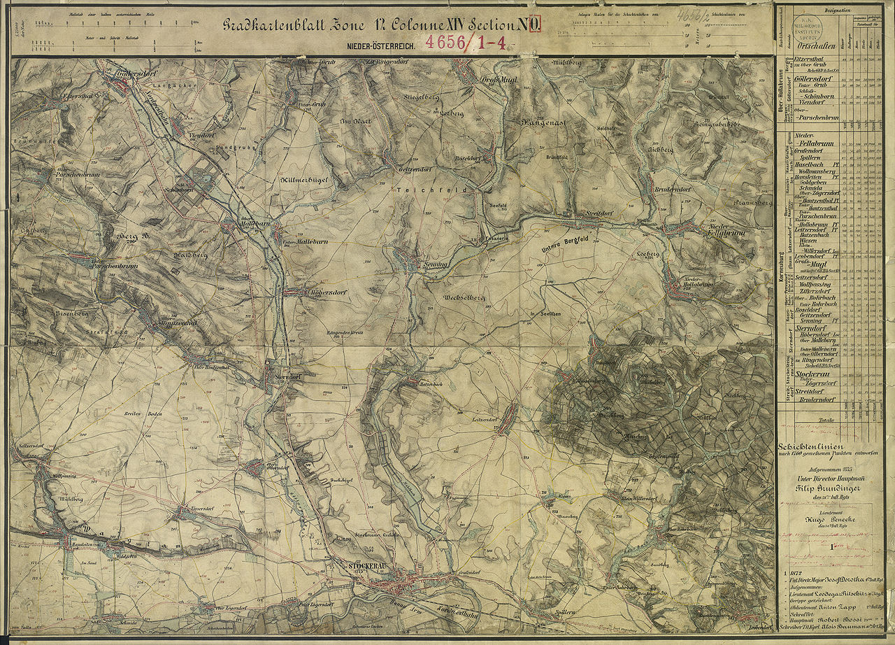
| Popis | historische Landkarte: Gradkartenblatt Zone 12 Colonne XIV Section NO (später 4656/2). Stockerau, Hausleiten, Göllersdorf, Parschenbrunn, Schönborn, Mallebern, Sierndorf, Großmugl, Waschberg, Niederhollabrunn im westlichen Weinviertel bzw. nordöstlichen Tullnerfeld. Franzisco-josephinische (3.) Landesaufnahme der österreichisch-ungarischen Monarchie. Aufnahmeblatt 1:25.000. Aufgenommen 1873 |
| Datum | mit einzelnen Nachträgen |
| Zdroj | Archiv des Militärgeographischen Institutes |
| Autor | Österreichisch-Ungarische Monarchie, Militärgeographisches Institut |
| Svolení (Užití tohoto souboru) |
historisches amtliches Werk aus dem 19. Jahrhundert, freies Werk |
Licence
|
Toto dílo je volné také v zemích, jejichž právní řád chrání majetková autorská práva po dobu života autora a 70 let po jeho smrti.
| |
| Bylo zjištěno, že u tohoto souboru nejsou známa žádná omezení daná autorským právem a právy s ním souvisejícími. | |
Historie souboru
Kliknutím na datum a čas se zobrazí tehdejší verze souboru.
| Datum a čas | Náhled | Rozměry | Uživatel | Komentář | |
|---|---|---|---|---|---|
| současná | 31. 1. 2010, 23:04 | | 10 110 × 7 286 (53,44 MB) | Josef Moser | {{Information |Description=historische Landkarte: Gradkartenblatt Zone 12 Colonne XIV Section NO (später 4656/2). Stockerau, Hausleiten, Göllersdorf, Parschenbrunn, Schönborn, Mallebern, Sierndorf, Großmugl, Waschberg, Niederhollabrunn im westlichen W |
Využití souboru
Tento soubor používá následující stránka:
Globální využití souboru
Tento soubor využívají následující wiki:
- Využití na azb.wikipedia.org
- Využití na de.wikipedia.org
- Využití na fr.wikipedia.org
- Využití na nl.wikipedia.org