
Soubor:Angola map.png
Větší rozlišení není k dispozici
Angola_map.png (326 × 351 pixelů, velikost souboru: 11 KB, MIME typ: image/png)
| Tento soubor pochází z Wikimedia Commons. Níže jsou zobrazeny informace, které obsahuje jeho tamější stránka s popisem souboru. |
Popis
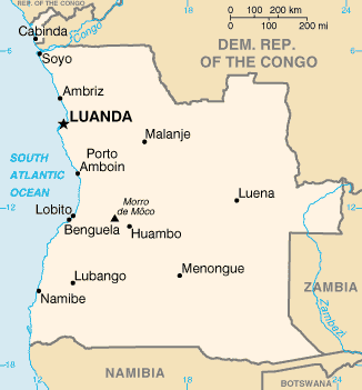
| Popis | Angola map from CIA World Factbook, converted from original GIF format |
| Datum | |
| Zdroj | CIA World Factbook |
| Autor | United States Central Intelligence Agency |
Licence
Tento obrázek je volné dílo, jelikož obsahuje materiál původně pocházející z publikace The World Factbook vytvářené Ústřední zpravodajskou službou Spojených států amerických.
|
 |
Historie souboru
Kliknutím na datum a čas se zobrazí tehdejší verze souboru.
| Datum a čas | Náhled | Rozměry | Uživatel | Komentář | |
|---|---|---|---|---|---|
| současná | 30. 10. 2021, 21:05 | | 326 × 351 (11 KB) | Auguel | Remove border |
| 15. 5. 2005, 14:12 |  | 330 × 354 (11 KB) | Nord68 | {{PD-USGov-CIA-WF}} |
Využití souboru
Tento soubor nepoužívá žádná stránka.
Globální využití souboru
Tento soubor využívají následující wiki:
- Využití na ar.wikipedia.org
- Využití na arz.wikipedia.org
- Využití na ast.wikipedia.org
- Využití na azb.wikipedia.org
- Využití na az.wikipedia.org
- Využití na ban.wikipedia.org
- Využití na bs.wikipedia.org
- Využití na ca.wikipedia.org
- Luanda
- Frontera entre Angola i la República Democràtica del Congo
- Frontera entre Angola i Zàmbia
- Llista d'aeroports d'Angola
- Llista de ciutats d'Angola
- Resolució 1045 del Consell de Seguretat de les Nacions Unides
- Resolució 1294 del Consell de Seguretat de les Nacions Unides
- Resolució 1348 del Consell de Seguretat de les Nacions Unides
- Llista de governadors colonials d'Angola
- Mòdul:Location map/data/Angola
- Mòdul:Location map/data/Angola/ús
- Využití na ckb.wikipedia.org
- Využití na cy.wikipedia.org
- Využití na dag.wikipedia.org
- Využití na da.wikipedia.org
- Využití na de.wikipedia.org
- Využití na diq.wikipedia.org
- Využití na dsb.wikipedia.org
- Využití na el.wikipedia.org
- Využití na en.wikipedia.org
- List of cities and towns in Angola
- List of colonial governors of Angola
- Talk:Geography of Angola
- United Nations Angola Verification Mission II
- List of airports in Angola
- Outline of Angola
- United Nations Security Council Resolution 1045
- United Nations Security Council Resolution 1294
- United Nations Security Council Resolution 1348
Zobrazit další globální využití tohoto souboru.