
Soubor:Rottnest Island.jpg
Velikost tohoto náhledu: 800 × 399 pixelů. Jiná rozlišení: 320 × 159 pixelů | 857 × 427 pixelů.
Původní soubor (857 × 427 pixelů, velikost souboru: 47 KB, MIME typ: image/jpeg)
| Tento soubor pochází z Wikimedia Commons. Níže jsou zobrazeny informace, které obsahuje jeho tamější stránka s popisem souboru. |
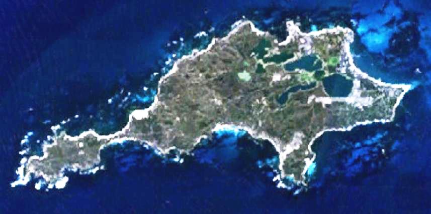
| Popis | This is a map of the Rottnest Island, Western Australia. | |||
| Zdroj | It was made by the uploader using NASA World Wind using Landsat 7 data. | |||
| Autor | Created by the uploader. Any IP involved in the creation of this image is released into the public domain. | |||
| Svolení (Užití tohoto souboru) |
|

Historie souboru
Kliknutím na datum a čas se zobrazí tehdejší verze souboru.
| Datum a čas | Náhled | Rozměry | Uživatel | Komentář | |
|---|---|---|---|---|---|
| současná | 24. 6. 2008, 01:28 | | 857 × 427 (47 KB) | Hesperian | Reverted to version as of 01:37, 1 May 2007 |
| 1. 5. 2007, 03:37 |  | 857 × 427 (47 KB) | Moondyne | {{Information |Description=This is a map of the Rottnest Island, Western Australia, made with World Wind using Landsat 7 data. (Adjusted for contrast) |Source= |Date= |Author=Created by the uploader. Any IP involved in the creation of this image is relea | |
| 16. 11. 2006, 05:16 |  | 857 × 427 (38 KB) | Hesperian | {{Information |Description=This is a map of the Rottnest Island, Western Australia, made with World Wind using Landsat 7 data. |Source= |Date= |Author=Created by the uploader. Any IP involved in the creation of this image is released into the public domai |
Využití souboru
Tento soubor používá následující stránka:
Globální využití souboru
Tento soubor využívají následující wiki:
- Využití na en.wikipedia.org
- Využití na fa.wikipedia.org
- Využití na fi.wikipedia.org
- Využití na fr.wikipedia.org
- Využití na gl.wikipedia.org
- Využití na he.wikipedia.org
- Využití na id.wikipedia.org
- Využití na ja.wikipedia.org
- Využití na ru.wikipedia.org
- Využití na ur.wikipedia.org
- Využití na www.wikidata.org
- Využití na zh-yue.wikipedia.org
- Využití na zh.wikipedia.org