
Soubor:Island of Ireland location map Tyrone.svg

Velikost tohoto PNG náhledu tohoto SVG souboru: 796 × 599 pixelů. Jiná rozlišení: 319 × 240 pixelů | 638 × 480 pixelů | 1 020 × 768 pixelů | 1 280 × 964 pixelů | 2 560 × 1 928 pixelů | 931 × 701 pixelů.
Původní soubor (soubor SVG, nominální rozměr: 931 × 701 pixelů, velikost souboru: 826 KB)
| Tento soubor pochází z Wikimedia Commons. Níže jsou zobrazeny informace, které obsahuje jeho tamější stránka s popisem souboru. |
| Popis |
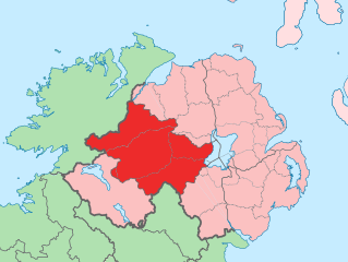
English: The island of Ireland, showing international border between Northern Ireland and Republic of Ireland, traditional provinces, traditional counties, and local authority areas in the Republic of Ireland and Northern Ireland. |
||
| Datum | (UTC) | ||
| Zdroj | Island of Ireland location map.svg | ||
| Autor | |||
| SVG vývoj | Tento vektorový obrázek byl vytvořen programem Adobe Illustrator
|
Já, držitel autorských práv k tomuto dílu, ho tímto zveřejňuji za podmínek následující licence:
Tento soubor podléhá licenci Creative Commons Uveďte autora-Zachovejte licenci 3.0 Unported
- Dílo smíte:
- šířit – kopírovat, distribuovat a sdělovat veřejnosti
- upravovat – pozměňovat, doplňovat, využívat celé nebo částečně v jiných dílech
- Za těchto podmínek:
- uveďte autora – Máte povinnost uvést autorství, poskytnout odkaz na licenci a uvést, pokud jste provedli změny. Toho můžete docílit jakýmkoli rozumným způsobem, avšak ne způsobem naznačujícím, že by poskytovatel licence schvaloval nebo podporoval vás nebo vaše užití díla.
- zachovejte licenci – Pokud tento materiál jakkoliv upravíte, přepracujete nebo použijete ve svém díle, musíte své příspěvky šířit pod stejnou nebo slučitelnou licencí jako originál.
Původní historie souboru
This image is a derivative work of the following images:
- Island of Ireland location map.svg licensed with Cc-by-sa-3.0
- 2010-03-06T20:43:33Z Rannpháirtí anaithnid 1450x1807 (679207 Bytes) Fix incorrectly coloured isands.
- 2010-03-03T22:19:29Z Rannpháirtí anaithnid 1450x1807 (679744 Bytes) {{Information |Description={{de|Positionskarte von [[:de:Irland|Irland]]}} Quadratische Plattkarte, N-S-Streckung 170 %. Geographische Begrenzung der Karte: * N: 55.6° N * S: 51.2° N * W: 11.0° W * O: 5.0° W {{en|Location
Uploaded with derivativeFX
Historie souboru
Kliknutím na datum a čas se zobrazí tehdejší verze souboru.
| Datum a čas | Náhled | Rozměry | Uživatel | Komentář | |
|---|---|---|---|---|---|
| současná | 19. 7. 2010, 14:53 | | 931 × 701 (826 KB) | Mabuska | another attempt |
| 19. 7. 2010, 14:41 |  | 931 × 701 (819 KB) | Mabuska | fixed boundaries | |
| 19. 7. 2010, 13:20 |  | 934 × 712 (827 KB) | Mabuska | {{Information |Description={{en|The island of Ireland, showing international border between Northern Ireland and Republic of Ireland, traditional provinces, traditional counties, and local authority areas in the Republic of Ireland and Northern Ireland.}} |
Využití souboru
Tento soubor používá následující stránka:
Globální využití souboru
Tento soubor využívají následující wiki:
- Využití na an.wikipedia.org
- Využití na ar.wikipedia.org
- Využití na ast.wikipedia.org
- Využití na bg.wikipedia.org
- Využití na ca.wikipedia.org
- Využití na de.wikipedia.org
- Využití na en.wikipedia.org
- Využití na es.wikipedia.org
- Využití na eu.wikipedia.org
- Omagh
- Lankide:Euskaldunaa
- Dungannon
- Cookstown
- Strabane
- Tyrone konderria
- Txantiloi:Tyrone konderriko udalerriak
- Coagh
- Coalisland
- Altamuskin
- Altishane
- Altmore
- Ardboe
- Ardstraw
- Artigarvan
- Augher
- Aughnacloy (Tyrone konderria)
- Ballygawley (Tyrone konderria)
- Ballymagorry
- Ballymully Glebe
- Benburb
- Beragh
- Brackaville
- Bready
- Brockagh
- Caledon (Tyrone konderria)
- Cappagh (Tyrone konderria)
- Carnteel
- Carrickmore
- Castlecaulfield
- Castlederg
- Clady (Tyrone konderria)
- Clanabogan
- Clogher
- Cranagh
- Creggan (Tyrone konderria)
- Derrycrin
- Derryloughan (Tyrone konderria)
- Derrytresk
Zobrazit další globální využití tohoto souboru.