
Soubor:Trinity crater.jpg
Velikost tohoto náhledu: 754 × 599 pixelů. Jiná rozlišení: 302 × 240 pixelů | 604 × 480 pixelů | 966 × 768 pixelů | 1 280 × 1 017 pixelů | 2 560 × 2 035 pixelů | 7 880 × 6 263 pixelů.
Původní soubor (7 880 × 6 263 pixelů, velikost souboru: 6,33 MB, MIME typ: image/jpeg)
| Tento soubor pochází z Wikimedia Commons. Níže jsou zobrazeny informace, které obsahuje jeho tamější stránka s popisem souboru. |
| Popis |
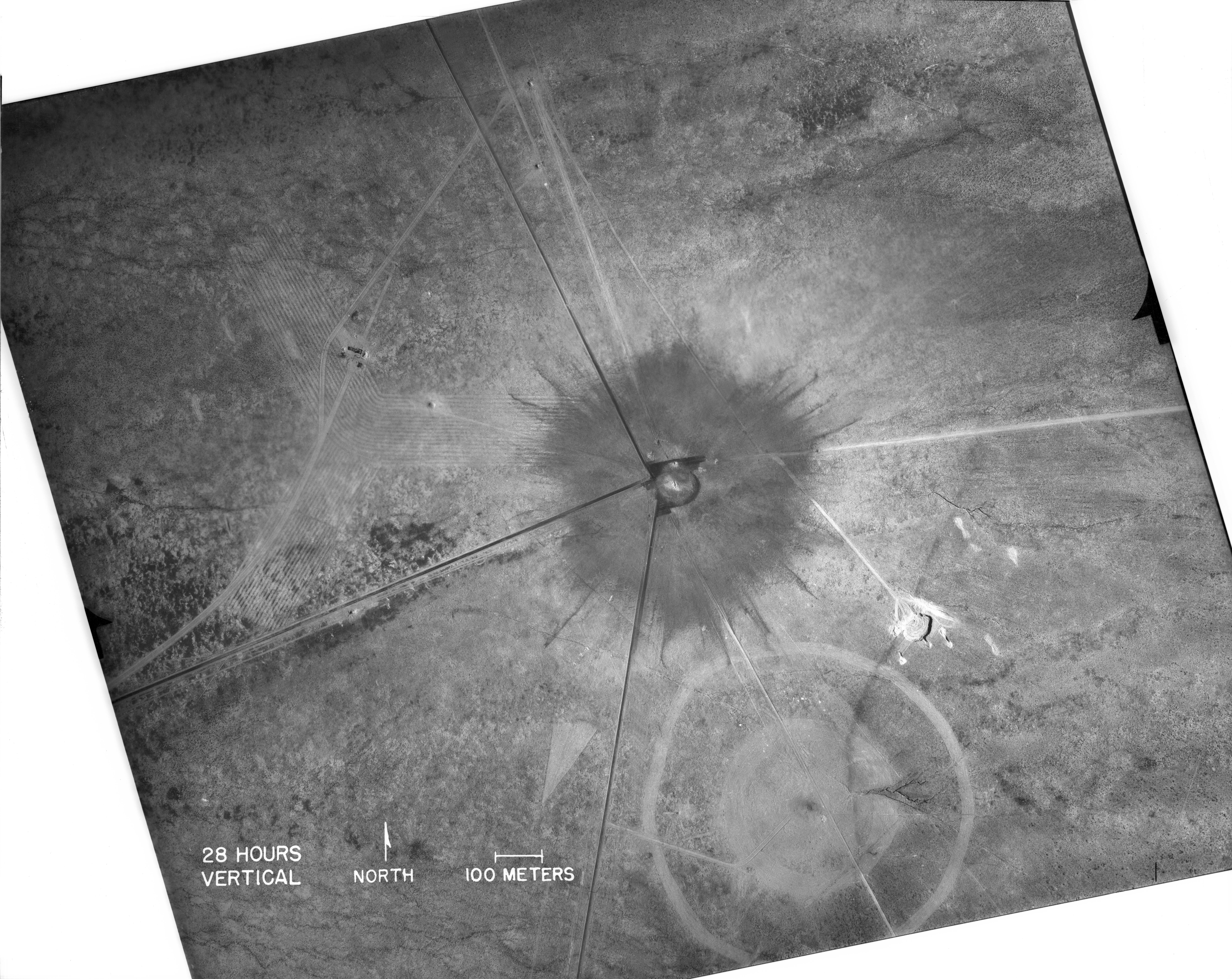
English: White Sands, New Mexico. Aerial view of the aftermath of the Trinity test, 28 hours after the explosion. The smaller crater to the southeast is from the earlier detonation of 100 tons of TNT on May 7, 1945. The dark straight lines are roads. To the left of the crater can be seen the "Jumbo" container, unharmed, and its collapsed tower (a vertical line). |
|
| Datum | ||
| Zdroj |
|
|
| Autor | Federal government of the United States | |
| Další verze |
|
.jpg)
_2.jpg)
| This image is a work of a United States Department of Energy (or predecessor organization) employee, taken or made as part of that person's official duties. As a work of the U.S. federal government, the image is in the public domain.
Please note that national laboratories operate under varying licences and some are not free. Check the site policies of any national lab before crediting it with this tag.
|

|
Historie souboru
Kliknutím na datum a čas se zobrazí tehdejší verze souboru.
| Datum a čas | Náhled | Rozměry | Uživatel | Komentář | |
|---|---|---|---|---|---|
| současná | 1. 10. 2016, 18:03 | | 7 880 × 6 263 (6,33 MB) | Quibik | Higher-res from https://www.flickr.com/photos/losalamosnatlab/19282799141/in/album-72157652920995393/ |
| 2. 12. 2005, 20:52 |  | 800 × 685 (190 KB) | Fastfission~commonswiki | better version | |
| 1. 9. 2005, 20:45 |  | 472 × 315 (50 KB) | Fastfission~commonswiki | From en: Aerial view of the aftermath of the Trinity test. The smaller crater to the southeast is from the earlier detonation of 100 tons of TNT. Not sure about the scale but those dark straight lines are probably roads. Created as part of the [[Man |
Využití souboru
Tento soubor používá následující stránka:
Globální využití souboru
Tento soubor využívají následující wiki:
- Využití na da.wikipedia.org
- Využití na fi.wikipedia.org
- Využití na ja.wikipedia.org
- Využití na pt.wikipedia.org
- Využití na ru.wikipedia.org
- Využití na sr.wikipedia.org
- Využití na www.wikidata.org