
Soubor:Pinus ponderosa subspecies range map.png
Velikost tohoto náhledu: 489 × 599 pixelů. Jiná rozlišení: 196 × 240 pixelů | 609 × 746 pixelů.
Původní soubor (609 × 746 pixelů, velikost souboru: 77 KB, MIME typ: image/png)
| Tento soubor pochází z Wikimedia Commons. Níže jsou zobrazeny informace, které obsahuje jeho tamější stránka s popisem souboru. |
| Popis |
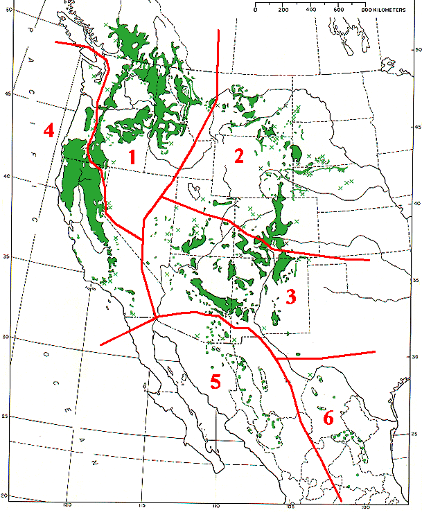
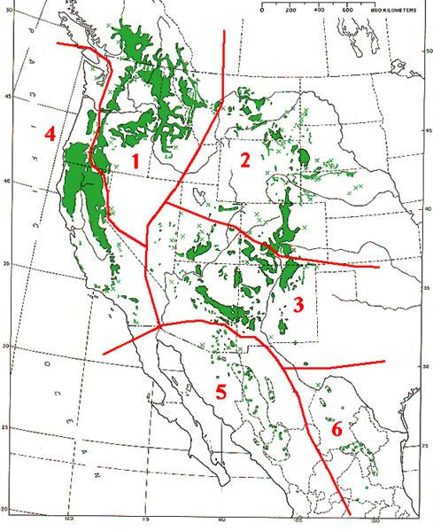
Range map of Pinus ponderosa and Pinus arizonica
|
|||
| Datum | ||||
| Zdroj | Base map (black outlines & green range map) is from USDA Forest Service Misc,.Publ. 991 (public domain-USGov); red delineation is my work, which I release into public domain | |||
| Autor | MPF | |||
| Svolení (Užití tohoto souboru) |
|
Historie souboru
Kliknutím na datum a čas se zobrazí tehdejší verze souboru.
| Datum a čas | Náhled | Rozměry | Uživatel | Komentář | |
|---|---|---|---|---|---|
| současná | 7. 12. 2009, 16:09 | | 609 × 746 (77 KB) | MPF | {{Information |Description=Range map of ''Pinus ponderosa'' and ''Pinus arizonica'' # ''Pinus ponderosa'' subsp. ''ponderosa'' - North Plateau Ponderosa Pine # ''Pinus ponderosa'' subsp. ''scopulorum'' - Rocky Mts Ponderosa Pine # ''Pinus ponderos |
Využití souboru
Tento soubor používá následující stránka:
Globální využití souboru
Tento soubor využívají následující wiki:
- Využití na arz.wikipedia.org
- Využití na ca.wikipedia.org
- Využití na el.wikipedia.org
- Využití na es.wikipedia.org
- Využití na id.wikipedia.org
- Využití na nl.wikipedia.org
- Využití na pl.wikipedia.org
- Využití na pt.wikipedia.org
- Využití na sv.wikipedia.org
- Využití na tr.wikipedia.org
- Využití na uk.wikipedia.org
- Využití na www.wikidata.org