
Soubor:Map of USA MA.svg

Velikost tohoto PNG náhledu tohoto SVG souboru: 286 × 186 pixelů. Jiná rozlišení: 320 × 208 pixelů | 640 × 416 pixelů | 1 024 × 666 pixelů | 1 280 × 832 pixelů | 2 560 × 1 665 pixelů.
Původní soubor (soubor SVG, nominální rozměr: 286 × 186 pixelů, velikost souboru: 167 KB)
| Tento soubor pochází z Wikimedia Commons. Níže jsou zobrazeny informace, které obsahuje jeho tamější stránka s popisem souboru. |
Clickable version
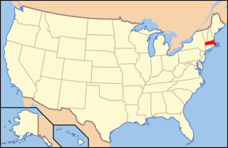
| Popis | Map of USA with Massachusetts highlighted | ||||||||
| Datum | see file history below. | ||||||||
| Zdroj | own work by uploader, based on Image:Map of USA without state names.svg | ||||||||
| Autor |
This version: uploader Base versions this one is derived from: originally created by en:User:Wapcaplet |
||||||||
| Svolení (Užití tohoto souboru) |
Tento soubor podléhá licenci Creative Commons Uveďte autora 2.0 Generic
|
||||||||
| Další verze | image:Map of USA with state names.svg |

Historie souboru
Kliknutím na datum a čas se zobrazí tehdejší verze souboru.
| Datum a čas | Náhled | Rozměry | Uživatel | Komentář | |
|---|---|---|---|---|---|
| současná | 9. 6. 2006, 09:00 | | 286 × 186 (167 KB) | Huebi~commonswiki | {{Information| |Description=Map of USA with Massachusettes highlighted |other_versions=image:Map of USA with state names.svg }} Category:Maps of the United States Category:Maps of Massachusettes Category:SVG maps {{GFDL-en}}{{cc-by-2.0} |
Využití souboru
Tento soubor používá následujících 20 stránek:
- Administrativní dělení Spojených států amerických
- Amherst
- Berlin (Massachusetts)
- Beverly (Massachusetts)
- Cambridge (Massachusetts)
- Concord (Massachusetts)
- Fitchburg (Massachusetts)
- Foxborough
- Leicester (Massachusetts)
- Oxford (Massachusetts)
- Peabody (Massachusetts)
- Provincetown
- Salem (Massachusetts)
- Shrewsbury (Massachusetts)
- South Deerfield
- Sterling (Massachusetts)
- Uxbridge (Massachusetts)
- Webster (Massachusetts)
- Williamstown (Massachusetts)
- Winchendon
Globální využití souboru
Tento soubor využívají následující wiki:
- Využití na af.wikipedia.org
- Využití na ang.wikipedia.org
- Využití na arc.wikipedia.org
- Využití na ay.wikipedia.org
- Využití na az.wiktionary.org
- Využití na ba.wikipedia.org
- Využití na bcl.wikipedia.org
- Využití na be-tarask.wikipedia.org
- Využití na bi.wikipedia.org
- Využití na bpy.wikipedia.org
- Využití na bxr.wikipedia.org
- Využití na ca.wikipedia.org
- Využití na ce.wikipedia.org
- Využití na co.wikipedia.org
- Využití na cu.wikipedia.org
- Využití na cv.wikipedia.org
- Využití na da.wikipedia.org
- Massachusetts
- Suffolk County (Massachusetts)
- Middlesex County (Massachusetts)
- Norfolk County (Massachusetts)
- Barnstable County
- Plymouth County (Massachusetts)
- Berkshire County
- Worcester County (Massachusetts)
- Hampshire County (Massachusetts)
- Hampden County
- Dukes County
- Bristol County (Massachusetts)
- Essex County (Massachusetts)
- Franklin County (Massachusetts)
- Využití na de.wikipedia.org
- Benutzer:Wolfgang1018/Wikipedia-Quiz
- Kategorie:Massachusetts
- Vorwahlergebnisse der Präsidentschaftswahl in den Vereinigten Staaten 2008
- Weinbau in Massachusetts
- Flaggen und Siegel der US-Bundesstaaten
- Vorwahlergebnisse der Präsidentschaftswahl in den Vereinigten Staaten 2016
- Vorwahlergebnisse der Präsidentschaftswahl in den Vereinigten Staaten 2020
- Vorwahlergebnisse der Präsidentschaftswahl in den Vereinigten Staaten 2024
- Benutzer:Sarkana/Vorwahlergebnisse 2024
- Využití na de.wiktionary.org
- Využití na el.wikipedia.org
- Využití na en.wikipedia.org
Zobrazit další globální využití tohoto souboru.