
Soubor:Map of Bremerhaven 1849.jpg

Původní soubor (1 772 × 1 328 pixelů, velikost souboru: 2,13 MB, MIME typ: image/jpeg)
| Tento soubor pochází z Wikimedia Commons. Níže jsou zobrazeny informace, které obsahuje jeho tamější stránka s popisem souboru. |
Popis
| Popis |
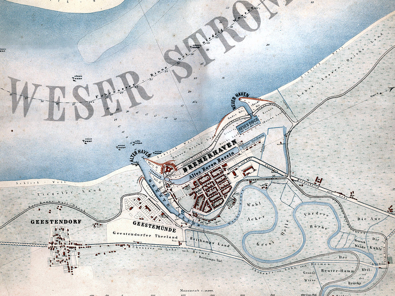
English: Map of the city of Bremerhaven, Germany from the year 1849.
Deutsch: „Bremerhaven mit den in Ausführung begriffenen neuen Havenanlagen“. Karte der Stadt Bremerhaven aus dem Jahr 1849.
Español: Mapa de la ciudad de Bremerhaven del año 1849.
Català: Mapa de la ciutat de Bremerhaven de l’any 1849. |
| Datum | |
| Zdroj | Hochschule Bremerhaven: Die Gebäude der Hochschule Bremerhaven. Wirtschaftsverlag NW, Bremerhaven 2005, ISBN 3-86509-250-0 |
| Autor | Georg Hunckel |
| Svolení (Užití tohoto souboru) |
Public domain because of age. |
| Další verze | Díla odvozená od tohoto souboru: Map of Bremerhaven 1849 2011 11 27 Hochhaus.jpg |
Licence
|
Toto dílo je volné také v zemích, jejichž právní řád chrání majetková autorská práva po dobu života autora a 70 let po jeho smrti.
| |
| Bylo zjištěno, že u tohoto souboru nejsou známa žádná omezení daná autorským právem a právy s ním souvisejícími. | |
Historie souboru
Kliknutím na datum a čas se zobrazí tehdejší verze souboru.
| Datum a čas | Náhled | Rozměry | Uživatel | Komentář | |
|---|---|---|---|---|---|
| současná | 29. 1. 2008, 19:03 | | 1 772 × 1 328 (2,13 MB) | Gepardenforellenfischer | {{Information |Description= {{en|Map of the city of Bremerhaven from the year 1849.}} {{de|Karte der Stadt Bremerhaven aus dem Jahr 1849.}} {{es|Mapa de la ciudad de Bremerhaven del año 1849.}} {{ca|Mapa de la ciutat de Bremerhaven de l’any 1849.}} |So |
Využití souboru
Tento soubor používá následující stránka:
Globální využití souboru
Tento soubor využívají následující wiki:
- Využití na be.wikipedia.org
- Využití na de.wikipedia.org
- Využití na hu.wikipedia.org
- Využití na hy.wikipedia.org
- Využití na la.wikipedia.org
- Využití na nl.wikipedia.org
- Využití na ru.wikipedia.org
- Využití na zh.wikipedia.org