
Soubor:USACE Englebright Dam and Lake.jpg

Velikost tohoto náhledu: 800 × 526 pixelů. Jiná rozlišení: 320 × 211 pixelů | 640 × 421 pixelů | 1 024 × 674 pixelů | 1 500 × 987 pixelů.
Původní soubor (1 500 × 987 pixelů, velikost souboru: 638 KB, MIME typ: image/jpeg)
| Tento soubor pochází z Wikimedia Commons. Níže jsou zobrazeny informace, které obsahuje jeho tamější stránka s popisem souboru. |
| Popis |
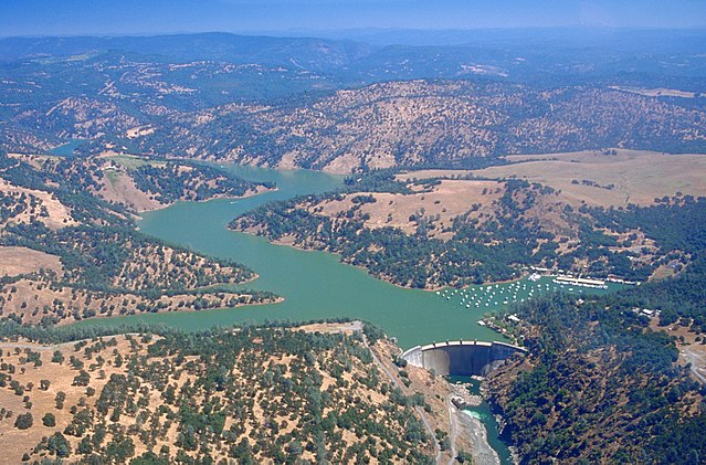
English: Englebright Dam and Lake on the Yuba River in the state of California, USA. The dam is located approximately 20 miles (32 km) east-northeast of Yuba City, California. The river and dam span the border between Yuba County and Nevada Counties. The dam was constructed in 1941 by the U.S. Army Corps of Engineers for flood control on the Yuba River.
Coordinates: 39°14′23.81″N 121°16′10.02″W / 39.2399472°N 121.26945°W |
|||
| Umístění | Yuba and Nevada Counties, California, USA | |||
| Datum | not specified or unknown | |||
| Zdroj |
U.S. Army Corps of Engineers Digital Visual Library Image page Image description page Digital Visual Library home page |
|||
| Autor | Michael Nevins, U.S. Army Corps of Engineers | |||
| Svolení (Užití tohoto souboru) |
|
Historie souboru
Kliknutím na datum a čas se zobrazí tehdejší verze souboru.
| Datum a čas | Náhled | Rozměry | Uživatel | Komentář | |
|---|---|---|---|---|---|
| současná | 5. 5. 2007, 17:27 | | 1 500 × 987 (638 KB) | DanMS | {{Information | Description = {{en|Englebright Dam and Lake on the Yuba River in the state of California, USA. The dam is located approximately 20 miles (32 km) east-northeast of Yuba City, California. The river and dam span the border between Yuba Cou |
Využití souboru
Tento soubor používá následující stránka:
Globální využití souboru
Tento soubor využívají následující wiki:
- Využití na ar.wikipedia.org
- Využití na az.wikipedia.org
- Využití na be.wikipedia.org
- Využití na ceb.wikipedia.org
- Využití na ce.wikipedia.org
- Využití na cy.wikipedia.org
- Využití na en.wikipedia.org
- Využití na en.wikivoyage.org
- Využití na eo.wikipedia.org
- Využití na es.wikipedia.org
- Využití na ga.wikipedia.org
- Využití na hu.wikipedia.org
- Využití na hy.wikipedia.org
- Využití na no.wikipedia.org
- Využití na pl.wikipedia.org
- Využití na pt.wikipedia.org
- Využití na ru.wikipedia.org
- Využití na sr.wikipedia.org
- Využití na tr.wikipedia.org
- Využití na tt.wikipedia.org
- Využití na www.wikidata.org