
Soubor:Bergpark wilhelmshoehe karte 1.jpg
Původní soubor (577 × 792 pixelů, velikost souboru: 276 KB, MIME typ: image/jpeg)
| Tento soubor pochází z Wikimedia Commons. Níže jsou zobrazeny informace, které obsahuje jeho tamější stránka s popisem souboru. |
| Popis |
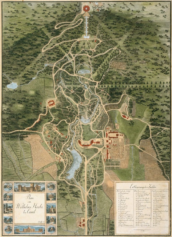
Deutsch: historische Karte Bergpark Wilhelmshöhe, ca. 1810
English: historic map of Bergpark Wilhelmshöhe, ca. 1810 |
||||
| Datum | cca 1810 | ||||
| Zdroj | Originally from de.wikipedia, uploded there by Hafenbar July 8, 2005; description page is (was) here | ||||
| Autor | Neznámý | ||||
| Svolení (Užití tohoto souboru) |
|
||||
Historie souboru
Kliknutím na datum a čas se zobrazí tehdejší verze souboru.
| Datum a čas | Náhled | Rozměry | Uživatel | Komentář | |
|---|---|---|---|---|---|
| současná | 18. 4. 2006, 21:15 | | 577 × 792 (276 KB) | Matt314 | {{Information| |Description= {{de|historische Karte Bergpark Wilhelmshöhe, ca. 1810}} {{en|historic map of Bergpark Wilhelmshöhe, ca. 1810}} |Source=Originally from [http://de.wikipedia.org de.wikipedia], uploded there by Hafenbar |
Využití souboru
Tento soubor používá následující stránka:
Globální využití souboru
Tento soubor využívají následující wiki:
- Využití na ca.wikipedia.org
- Využití na da.wikipedia.org
- Využití na de.wikipedia.org
- Využití na el.wikipedia.org
- Využití na fr.wikipedia.org
- Využití na hr.wikipedia.org
- Využití na it.wikipedia.org
- Využití na lt.wikipedia.org
- Využití na nl.wikipedia.org
- Využití na no.wikipedia.org
- Využití na pt.wikipedia.org
- Využití na ro.wikipedia.org
- Využití na sv.wikipedia.org
- Využití na www.wikidata.org